

An innovative business approach blazes new trails for how surveying will be performed in the future.
What would it take to operate a surveying firm that was fast, ultra-responsive, high-quality and cost-competitive?
This was the question that weighed on Eric Ackerman, PLS. An astute problem solver who had first discovered his passion for surveying in high school in the late 1980s, Ackerman began noticing an unsettling trend in the late 2000s. Construction contractors, land developers, transportation agencies and even private homeowners in his home state of California were struggling to find surveyors that offered satisfactory service, quality and value.
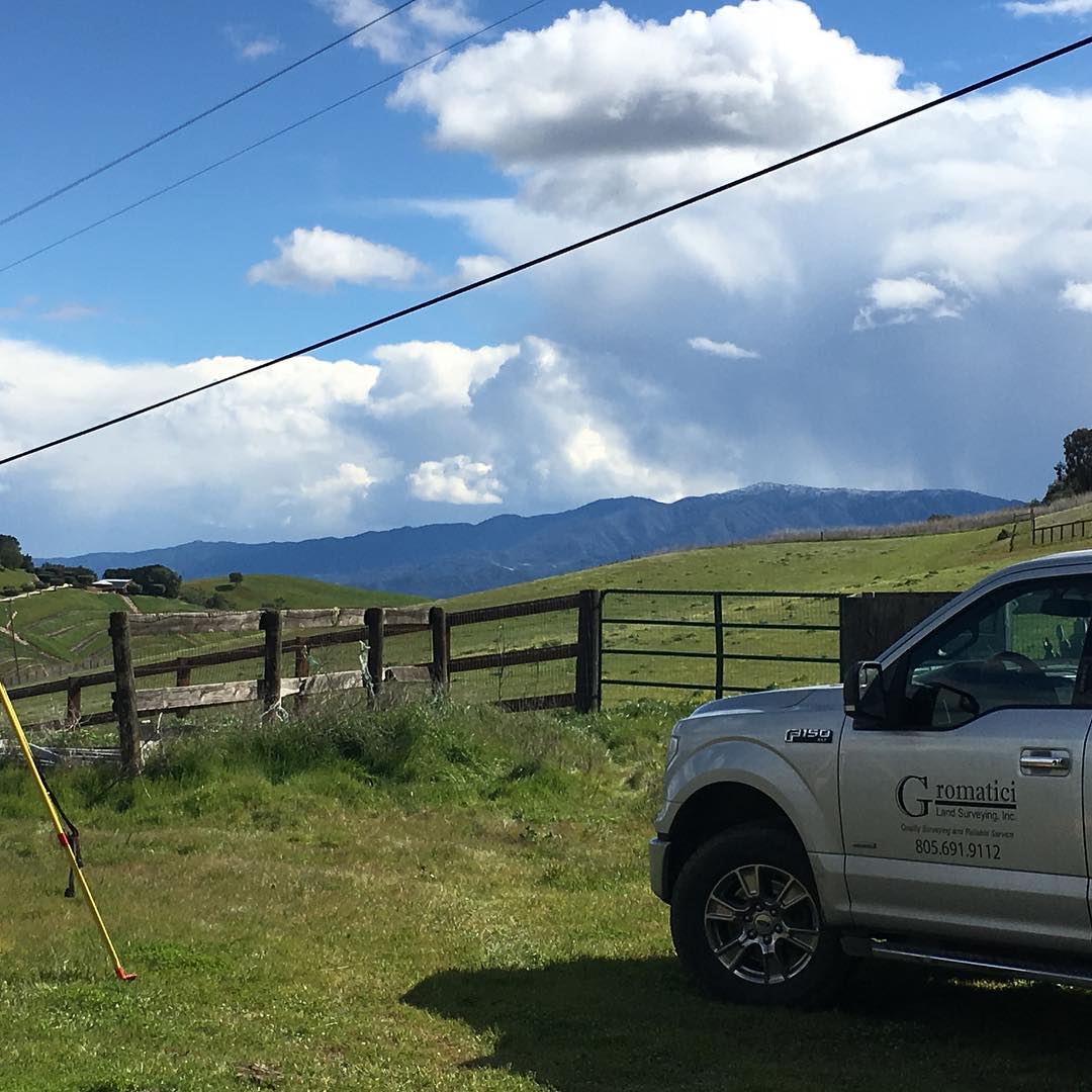
Ackerman believed he had the answer, and in 2010 he launched his firm, Gromatici Land Surveying, Inc., based in Santa Barbara, CA. Starting as a solo surveyor with a Leica robotic total station and a GPS rover, Ackerman quickly built a solid client base and steadily grew his business. He became a Certified Federal Surveyor (CFedS), expanded his team to include several other surveyors, and invested in a Leica MultiStation to add another robot with laser scanning capabilities. Soon after, he became licensed in four additional states (Arizona, Idaho, Nevada and Colorado), opened a second office in Los Olivos, CA, became a licensed drone pilot and acquired a drone for use in aerial mapping and topographic surveys.
With each new technology investment, Ackerman recognized a distinct advantage. Setup time decreased, quality and efficiency increased, and the amount of work he was able to handle with his small team expanded. “We can do the same work as a large firm, with the same or higher level of quality and service, but at a significant value,” he says. “It all comes down to our technology and people.”
GNSS Innovation Takes Efficiency to the Next Level
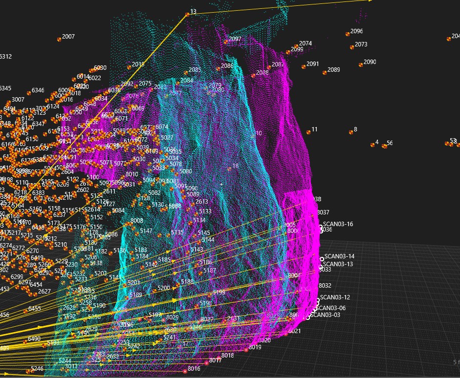
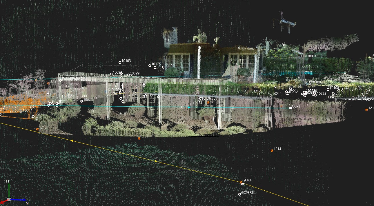
Recently, Ackerman decided it was time to upgrade the company’s GNSS rover. At Vision 2020, the virtual joint conference of APLS, CLSA and NALS held in August 2020, he saw an unusual approach—a GNSS smart antenna that uses tilt technology and also captures measurable images as the operator walks around the site. Ackerman was intrigued by the visual positioning capabilities of the GS18 I.
“Efficiency is paramount; we have to keep looking for ways to be faster,” Ackerman says. “The GS18 I is an innovative GPS unit that I saw right away would be a really big time saver.”
 “We can do the same work as a large firm, with the same or higher level of quality and service, but at a significant value. It all comes down to our technology and people.”
– Eric Ackerman, PLS, CFedS
An in-person demo from his local Leica Geosystems representative, Jason Paris, gave Ackerman more insight into the instrument’s capabilities. He experimented with the tilt function and realized he could save almost a minute on every shot with that capability alone by eliminating the need to level the pole. He had already been using Infinity office software with the MultiStation. With the GS18 I data, Infinity would streamline point calculations and adjustments.
And then there were the visual positioning capabilities of the instrument.
“The GS18 I really speeds up the collection work,” Ackerman says. “I once did a lot of ALTAs in Los Angeles, where we had to show the locations of the utility boxes. We had to put a rag tape down and do station and offset to all of them, which was time consuming. Now we can walk with that GS18 I and just capture the utility boxes as we’re walking. We can capture details like trees. If we’re doing a landscape survey and there are rock walls and other features, we can easily capture those for the landscape architect. And having all the data in the images is great for QA/QC.”
Ackerman moved forward on the investment and immediately saw the benefits. “We were pretty much using it out of the box right away,” he says. “The whole package together is really efficient. It’s fast to set up and easy to use, and it’s a powerful platform.”
Innovation Changes Client Expectations
Gromatici Land Surveying handles a diverse array of projects, from ALTA/NSPS surveys and elevation/flood certificates, to right-of-way engineering and topographic surveys for transportation and infrastructure and cell tower surveys; from large construction staking projects to small landscaping surveys. Having the right tool for each project is imperative.
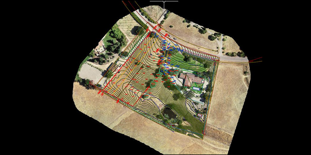
Sometimes the right combination of tools makes all the difference. Since Infinity software handles drone data along with other sensor data, the firm has found a niche using both their GS18 I and drone to quickly capture comprehensive ground-level and aerial data and imagery. The approach saves time and generates impressive deliverables.
Jason Paris Demonstrates Adding GS18 I GNSS Data to Drone Data – Watch Below
On other projects, the GS18 I enables the company to quickly capture imagery and measurements where they can’t use a drone—for example, due to flight restrictions or tree cover.
Ackerman’s innovative approach has transformed clients’ expectations of land surveying. The first thing they notice when they work with Gromatici Land Surveying is the service—calls are either answered immediately or returned right away. The next thing they notice is how quickly the surveyors get started on their project and how fast they begin working when they arrive onsite, with no downtime for setup. And they’re finished just as quickly—not only with the field work, but with the complete turnaround on deliverables that typically exceed expectations.
![]()
“When future surveyors see Gromatici on a tag, they’ll know it’s quality work and they can trust what they’re retracing. But the service aspect is also key.”
– Eric Ackerman, PLS, CFedS
“Our crew chief said we need to raise our rates because we’re so much faster now,” Ackerman laughs. Then he pauses as he thinks back on his first 11 years in business. “I want to leave a legacy,” he says. “When future surveyors see Gromatici on a tag, they’ll know it’s quality work and they can trust what they’re retracing. But the service aspect is also key. As a small business, we’re able to provide big business customer service. That’s extremely gratifying.”

To talk to one of our experts and learn more about solutions for surveying and mapping, please contact us.


