
May 5, 2020 – Do you need laser scanning experience before you add mobile mapping to your surveying capabilities? How much data does a mobile mapping system capture, and how reliable is it? How much time and skill is needed to process the data and create high-value deliverables?

An on-demand webinar series led by Mobile Reality Capture Expert Jason Ellis explores these questions and more to help you make the best decisions for your firm and quickly grow your business.
———————————————————-
NOTE: The new Leica Pegasus TRK, launched in May 2022, brings even more opportunities for mobile mapping through its autonomy, intelligence and simplicity. Learn more about the Pegasus TRK here >
———————————————————-
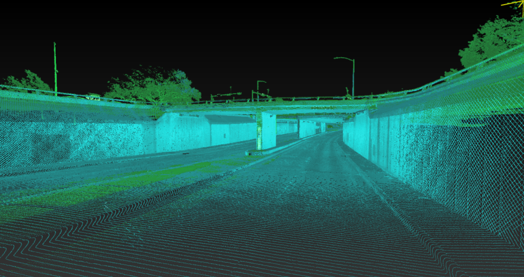
Getting Started in Mobile Mapping
The first session covers the basics of mobile mapping and rapid data acquisition. Mobile mapping is more than just LiDAR; it is the integration of multiple remote sensing technologies synchronized for complete and rapid digitalization. So how can you correctly evaluate different systems to ensure the right fit for your firm? Jason explains how the core technology works and show you what to look for in a turnkey approach to data collection, processing, analysis, production, support and service.

In session 2, Jason discusses how to get a jump start on becoming a mobile mapping pro through post-processing. Many people believe mobile mapping is a difficult and time-consuming process that requires a highly technical analysis to arrive at a usable dataset. However, post-processing data in a simple and intuitive batch-driven approach can drive efficiency in data processing and optimize accuracy. You’ll learn how to quickly get started and execute post-processing for review, analysis and high-value deliverable creation.
Fine-Tuning Data and Creating High-Value Deliverables
Session 3 will show you how to fine-tune mobile mapping system (MMS) data. Adjusting MMS data used to be a complicated process that required multiple software platforms to achieve and document high relative and global accuracies. That has all changed through intelligent adjustment technology and all-in-one production platforms geared for simple workflows and detailed reporting. Jason will walk you through the accuracy requirements for different project types and show you how to leverage smart toolsets and rich reporting to meet project specifications.
In session 4, you’ll explore a fast, new way to create striking MMS deliverables. MMS datasets are complete and highly detailed, but covering large areas such as roads, railways, construction sites or entire cities to create meaningful deliverables can be a time-consuming production challenge. The solution is to reshape the way production is handled by allowing for enhanced extraction capabilities within the MMS software. Jason will show you how it works and what it can do for your business.
To learn more about mobile mapping, follow Jason Ellis on LinkedIn.
To explore surveying solutions that can help you maximize productivity and performance, please contact us.


