

East Bay Municipal Utility District’s implementation of innovative GNSS-based monitoring raises the bar on dam safety.
It’s hard to imagine now given the extreme drought conditions on the West Coast, but in early 2017 winter storms filled and then overfilled reservoirs, threatening 770-foot tall Oroville Dam. It’s the nation’s tallest dam and impounds Lake Oroville, California’s second largest manmade lake, capable of storing more than 3.5 million acre-feet. As the dam reached and then exceeded capacity, the main and emergency spillways were damaged, leading to the evacuation of 188,000 downstream citizens. It was a sobering reminder that infrastructure matters, and that infrastructure can fail.
About 100 miles away, the Pardee Dam, along with Camanche Main Dam and Dikes 1 through 6, impound the Pardee and Camanche reservoirs. The two reservoirs have a total capacity of approximately 620,000 acre-feet and are the centerpiece of the East Bay Municipal Utility District’s (EBMUD) water supply system, which serves 1.4 million customers in the Bay Area’s Alameda and Contra Costa counties. (About 90 percent of EBMUD’s water supply comes from Pardee Reservoir.) These reservoirs also filled from the 2017 storms, reaching 103 percent of capacity in March, but the dams were not overtopped and releases were sustainable within the waterways. Thanks to the installation of one of the nation’s most advanced automated GNSS-based dam monitoring systems at these two facilities, along with other instrumentation improvements, EBMUD had the technology in place to monitor crest elevations at these dams and dikes remotely with improved temporal resolution. Having this type of data available is one more tool in an infrastructure owner’s tool belt for monitoring the condition and performance of critical facilities.
 “EBMUD is committed to automating processes where it makes sense. In this case, due to the remote location and critical nature of the infrastructure, it made a lot of sense.”
– Former EBMUD Survey Supervisor Steven J. Martin, LS
“The original survey monitoring system developed in the 1960s at Camanche Dam and Dikes involved sight-lining from reference monuments adjacent to the structures along with differential levelling,” says former EBMUD Survey Supervisor Steven J. Martin, LS. “After the advent of real time kinematic (RTK) GPS surveying in the 1990s, staff had taken to running the sight lines with RTK; however, with the differential leveling, it was still a labor-intensive approach that took over a week to complete.”
The old monitoring scheme technically met dam safety requirements but only provided semiannual data on dam crest displacements, leaving significant room for improvement in spatial and temporal resolution. “EBMUD is committed to automating processes where it makes sense,” Martin says. “In this case, due to the remote location and critical nature of the infrastructure, it made a lot of sense.”
Designing for Better Data
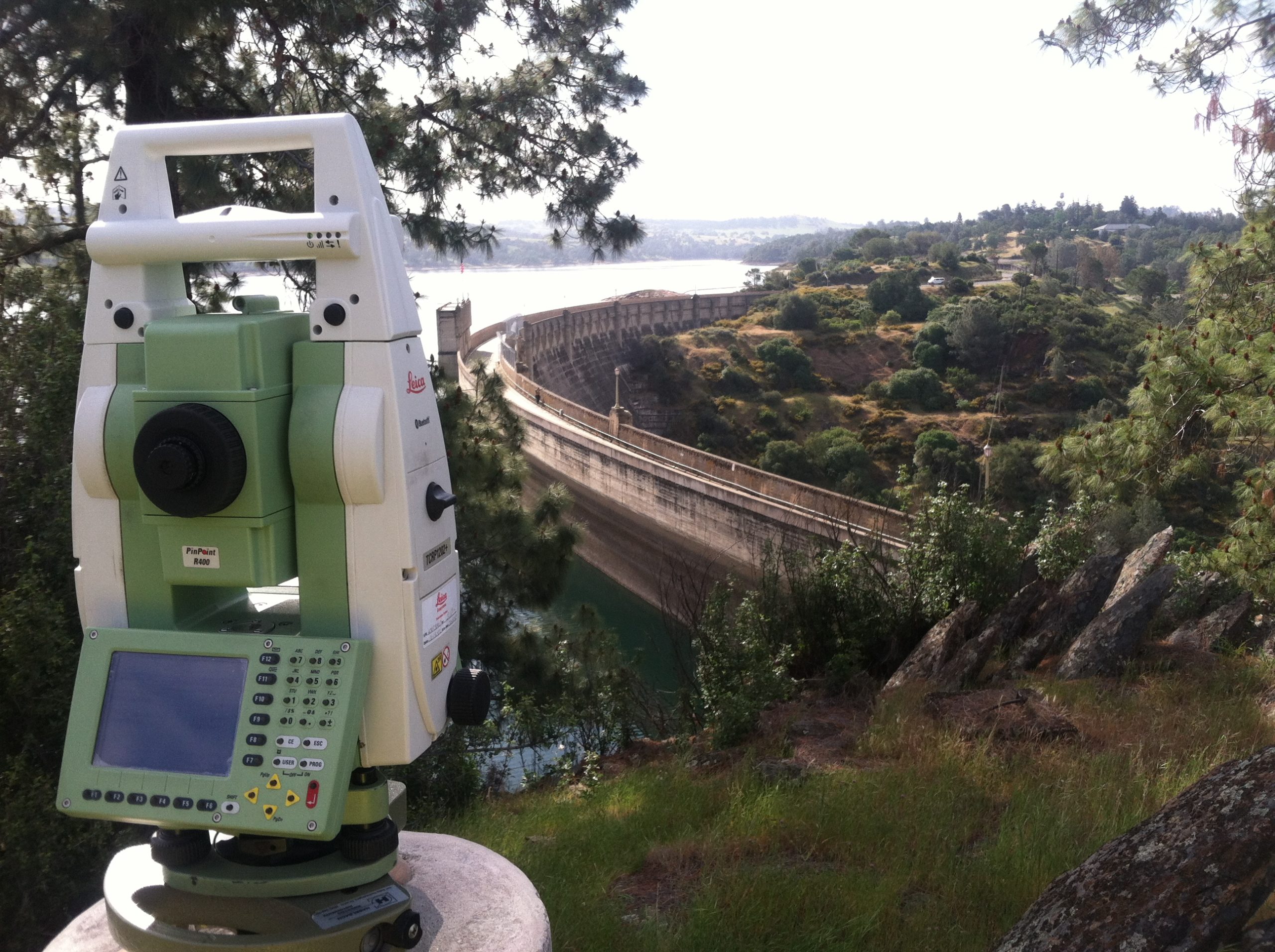
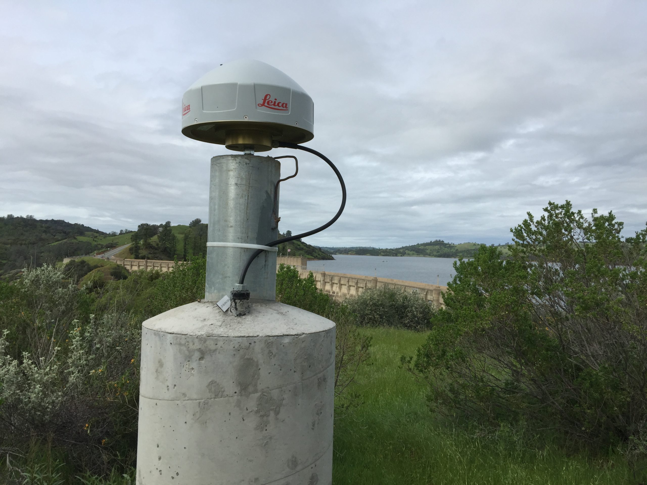
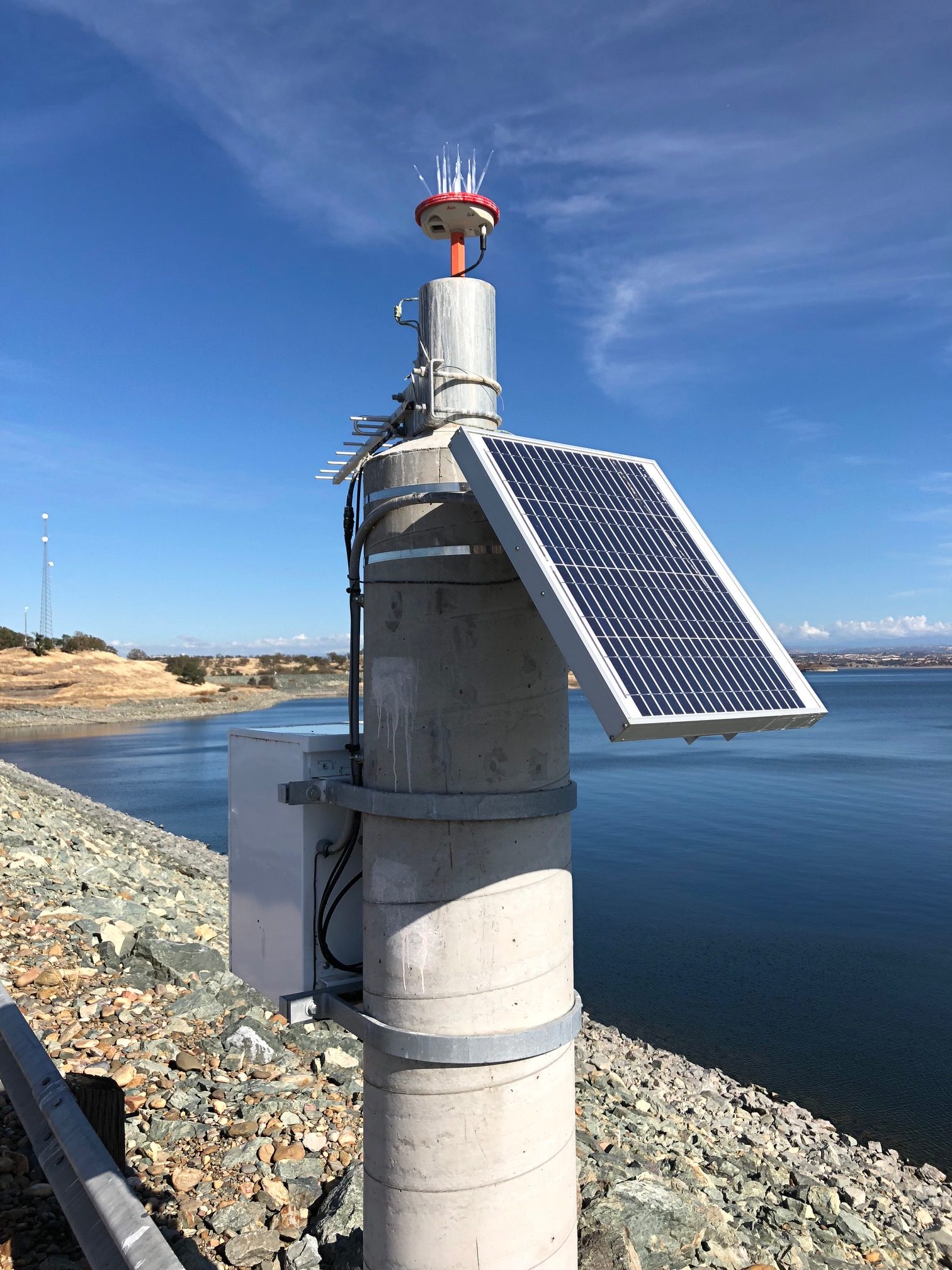
Consulting with Cory Baldwin, president of sensemetrics, a San Diego firm specializing in networked sensor applications, EBMUD designed and proposed a sophisticated monitoring system based on a total of 31 Leica GMX901+ GPS sensors, four Leica GM10 GNSS reference stations, a radio network consisting of 900 Mhz mesh radios, 2.4 Ghz repeaters and two radio towers, feeding into the Leica GNSS Spider and GeoMoS software solutions. The use of Leica Geosystems receivers is important, according to Baldwin. “The GMX901+s are purpose-built for remote monitoring applications, with non-exposed, built-in antennas,” he says. “They were my first choice here, because other vendors don’t really have a good option for monitoring in this environment.”
Three of the GNSS reference station receivers are solar powered and one is powered by a 120v AC feed. All are securely fastened inside enclosures installed near the Leica AR20 antennas, which are mounted on concrete pedestals. The network is largely autonomous, needing only occasional attention. Data flow is through 900 Mhz and 2.4 Ghz spread spectrum radios into an existing microwave telemetry link to EBMUD’s business intranet at its Oakland headquarters, where a server runs the Leica Spider and GeoMos software necessary to process the GNSS data and results. The results are then presented through software customized by sensemetrics.
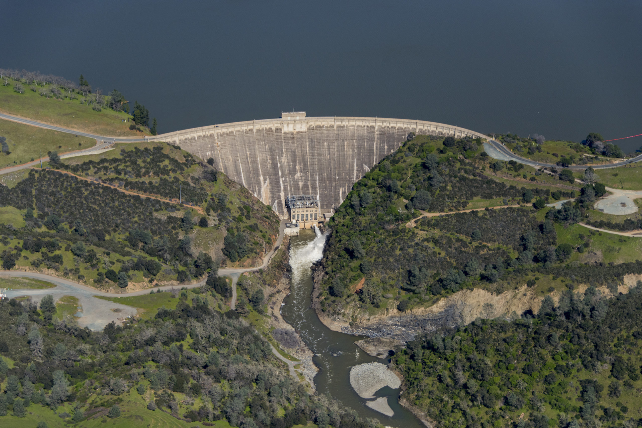
Five of the Leica GMX901+ sensors as well as four seismographs are installed on the Pardee Dam connected via fiberoptic cable directly to the microwave business intranet. These instruments continuously monitor dam movement and report remotely. Two of the Leica GM10 reference stations were installed near and on either side of Pardee Dam and are connected to the fiberoptic line by 2.4 Ghz radio connections.
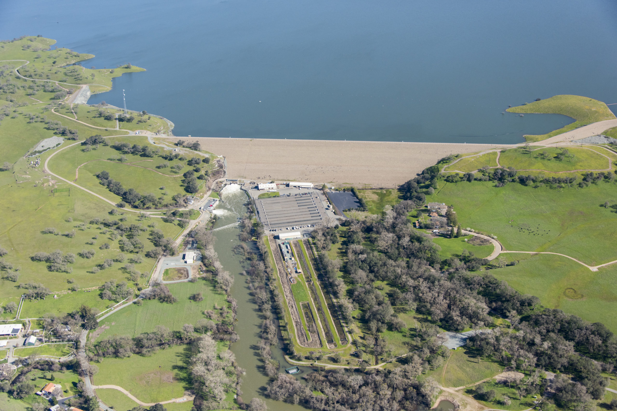
Downstream from Pardee Dam, the Camanche Reservoir site consists of one large earth-filled dam and six dikes. Camanche Reservoir is primarily used to control releases to downstream agencies and maintain flows for the salmon. Twenty-six Leica GMX901+ sensors are installed around the reservoir, and these also monitor and report continuously.
“This new system provides more accurate data, more or less constantly, and of course reduces the time survey crews spend on this task. It’s a big improvement, and it is performing beyond expectations.”
A Complete Picture of Infrastructure Performance
The State of California Division of Safety of Dams (DSOD) requires semiannual monitoring surveys. The new system provides more accurate information more rapidly, reduces staff time spent on monitoring, and is capable of being tied into statewide emergency and seismic monitoring systems as they emerge. After almost two years of service, DSOD monitoring requirements have been met with a more complete picture of overall performance.
“EBMUD’s infrastructure is spread out over a vast area and covers multiple counties,” says Baldwin. “In particular, the Pardee and Camanche sites are several hours away from main offices, and the semiannual surveys took over a week to complete. This new system provides more accurate data, more or less constantly, and of course reduces the time survey crews spend on this task. It’s a big improvement, and it is performing beyond expectations.”
Baldwin says one important design goal was interconnectivity with existing and future monitoring systems. “For obvious reasons, California, and especially the Bay Area, is really focused on being responsive to seismic events, and continuous monitoring and alerting is a big part of that,” he says. “This big network is exemplary when it comes to continuous, autonomous monitoring and alerting, and the software design makes it easy to add in more sensors if needed. Down the line, the information can be directly tied into statewide systems. The potential to automate and improve emergency responses to seismic events is a major advantage of monitoring networks.”
“While the goal is to eliminate the legacy manual-read monitoring systems, inevitably issues with a power supply or other minor components will crop up and require some attention. Sensemetrics provided support and training through the first two years to help resolve most issues, and Leica Geosystems updated firmware based on feedback from the project. So while the labor of a manual read system will go away, some more technical support and software skills are required in an automated system. The trade-off between having an automated monitoring system that gives you a survey every day (or every hour if you wish) verses a survey only twice a year is worth the investment,” according to Martin. “Once a communications backbone is built out to support an automated survey system, other automated sensors such as seismic recorders or vibrating wire piezometers (measures water pressure inside the dam) can easily be added to the system,” he says. Installation of this network was a proactive system improvement. EBMUD now has more survey information immediately at its fingertips regarding structure performance than at any previous moment in the district’s history. By being proactive and automating monitoring systems, EBMUD has greatly improved dam safety monitoring.
“The GNSS system at Pardee Dam now gives us a complete picture of the seasonal deformations due to thermal expansion and contraction of the concrete structure,” says Martin. “With the Camanche Reservoir portion of the GNSS monitoring system, we are able to meet DSOD monitoring requirements without long trips out of town by the survey crew and to check for any possible deformations remotely in near real time.”
To talk to one of our experts and learn more about solutions for surveying and monitoring, please contact us.


