

Total stations are extremely precise and powerful measurement systems. Highly complex in mechanical and electro-optical design, and controlled with efficient and easy-to-use onboard software, modern total stations offer substantial productivity benefits for daily measurement and stakeout tasks.
Yet despite all the technology advances, the initial setup procedure for many total stations remains the same. Before you can begin your work, you must first level and center the instrument above a given point on the ground to deliver the 2D link to a common and higher-ranked coordinate system, and then measure the instrument height to the ground to ensure that you will be able to deliver the full 3D reference of the collected data.
This process takes time, and any errors can affect the accuracy of the results. Still, it’s probably just an accepted part of your standard field setup procedure.
But what if it doesn’t have to be?
Measure Height with a Button Press
With a technology advance pioneered by Leica Geosystems, called AutoHeight, you simply press a button in the setup app, and the instrument measures its own height. Total stations with this capability incorporate a downward-facing laser plummet with an electro-optical distance measurement (EDM) system. A sensor uses a pointer mode to center above the ground, and the EDM mode measures the instrument height where the visible laser hits the ground. This measurement, which is accurate to within 1 mm, is captured in seconds and automatically applied in the setup app. A specific target is not required, so this capability can be used to measure any surface.
Benefits of AutoHeight
AutoHeight accelerates total station setup by eliminating the need to manually measure the instrument’s height. Other benefits include:
- Faster and reliable measurement
- Reduced time spent on rework or remeasurement
- Accurate audit trail thanks to the documentation on who captured the data, when and where
- Low learning curve to operate the equipment
- The lowest total cost of ownership
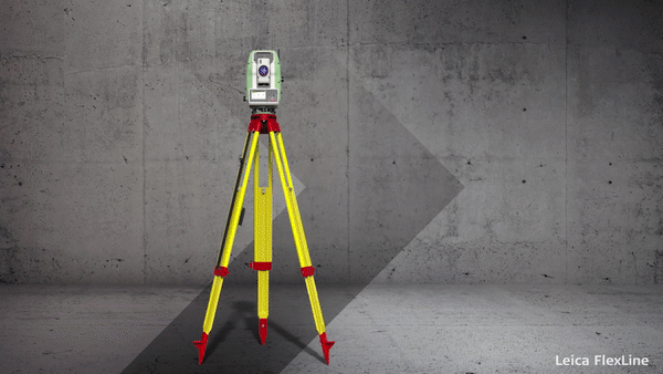
Originally introduced on the Leica FlexLine total stations, AutoHeight is now available on all Leica Geosystems current model surveying total stations and is a capability not found on instruments from other manufacturers.
To explore other ways to streamline your instrument setup and maximize your surveying productivity, please contact us.


