GS18 I

The Mastermind

The world’s first GNSS smart antenna with visual positioning, the GS18 I redefines what an
RTK rover is capable of.

Imaging Sensor
Intelligence

Advanced Wide Spectrum Processing Engine & Sensor

Artificial
Intelligence

Inertial
Measurement Unit

ENVIRONMENTAL
RATING

IP68

Durability

SMARTCHECK

99.99%

Reliability

CONNECTIVITY

555

Channels

Learn About Visual Positioning

Get an in-depth walkthrough of what visual positioning is along with real world examples.

For more details, please contact us

    Please tell us more about how we can help you.


    captcha

    Leica Geosystems Privacy Policy describes how we process your personal data, as well as information on how you may exercise your rights to updates, access, manage, export, and delete your personal data.

    If you subsequently change your mind, you may withdraw consent at any time by clicking on the "Unsubscribe" link within the marketing emails sent to you.

    By submitting this form you agree to Leica Geosystems Terms of Use.

    THANK YOU

    your request has been successfully submitted

    Visual Positioning

    The GS18 I matches the same intelligent tilt technology of the GS18 T and the advanced signal tracking capabilities of the smartest GNSS antennas—but the GS18 I takes another step forward in technological innovation. With the new addition of an imaging sensor, the GS18 I lets you perform photogrammetric measurements on the fly. Its cutting-edge implementation of sensor fusion empowers you to take your efficiency to a whole new level and at the same time overcome traditional GNSS obstacles such as measuring under a building canopy, dealing with multipathing and even performing vertical measurements of facades, all without resorting to costly alternative measurement options or putting yourself in harm’s way.

    A PICTURE IS FASTER THAN A POLE CAN MEASURE

    The GS18 I captures images at a frequency of 2 Hz while the operator walks. Those images are processed in real-time and can be used for measuring points immediately after capture stops. Points can then be measured with a simple click. It’s that easy. And in case you are back in the office and discover you need more measurements, all you have to do is use your imagery, no need to return to the field.

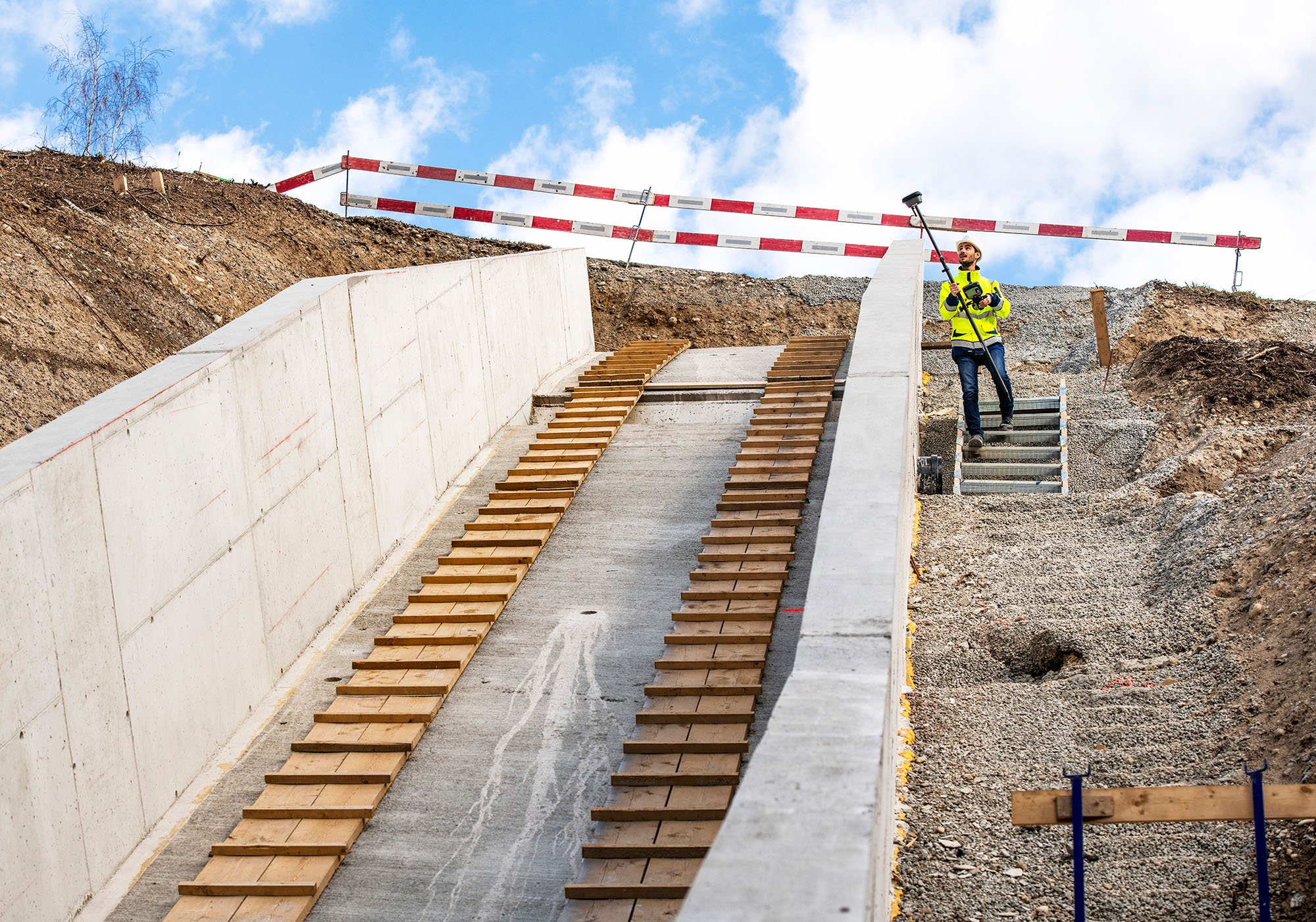
    Measuring bridge abutments.

    Measuring hard to reach areas.

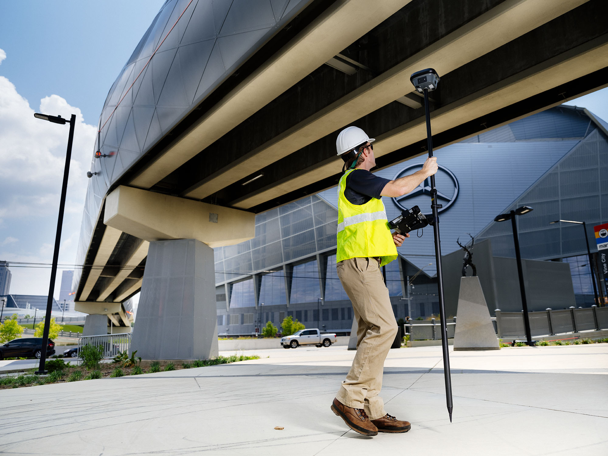
    Measuring under overhangs.

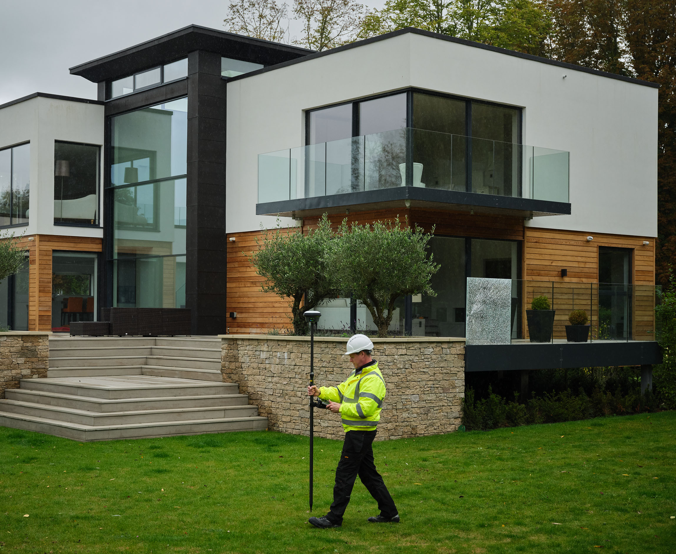
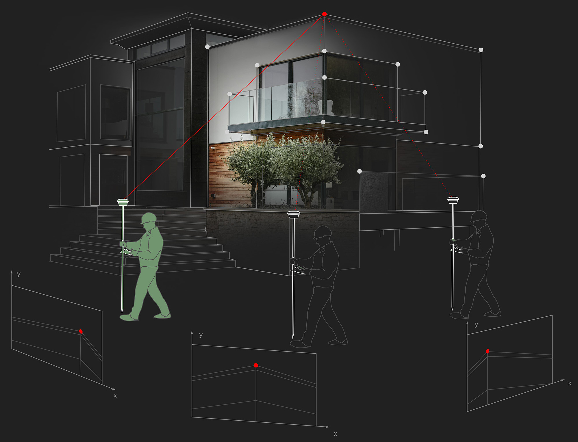
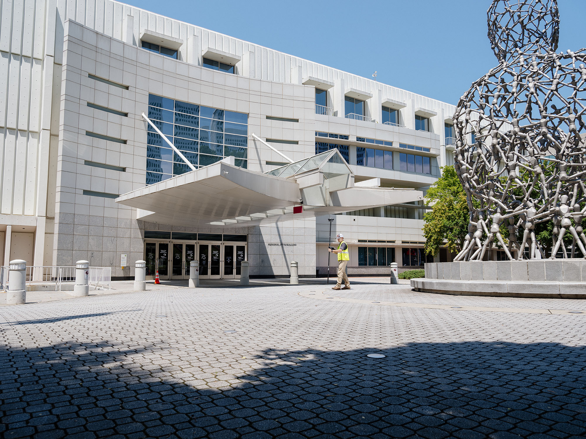
    Measuring points on a facade.

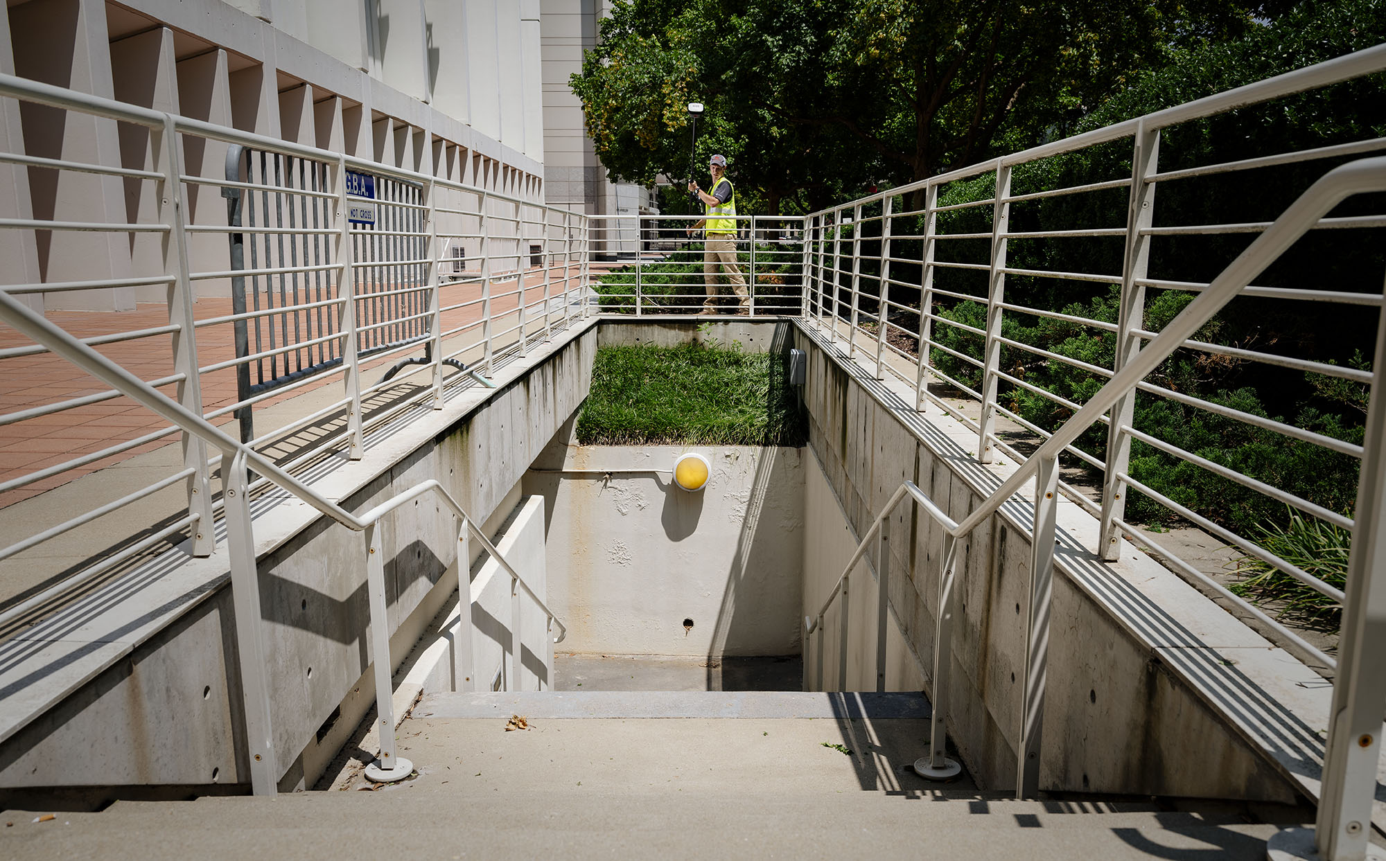
    Capturing details in a trench.

    Capturing measurements over a wall.

    Overcoming ChallEnges

    Traditional challenges call for modern measures. Often inaccessible points such as across a busy street, behind a gate or in dangerous areas, is where the GS18 I shines. But also in places with GNSS signal obstruction (e.g. under a roof, balcony or tree). Or having to measure points on a facade of a building (e.g. corners of a window and height of the roof) have all become much easier.

    3D Visualization

    3D point clouds can be a powerful tool to help team members visualize and collaborate more effectively. With the new GS18 I, you will be able to easily do just that.

    Survey-Grade Accuracy

    With the use of the GS18 I’s sensor fusion, it is able to achive survey grade accuracies while measuring from images.

    Insights

    Be inspired by the success of other surveyors and discover how to maximize quality, efficiency and productivity.

    CAPTIVATE

    Companies often can get lost in the race to add features while forgetting about the most important element, you. With Captivate, we focused on bringing back the human side to technology.

    LEICA ACTIVE ASSIST

    Solve your problems in the field with the help of our support team that can remotely access your device and assist with any needs in the field.

    LEICA EXCHANGE

    Easily and seamlessly sync your data with the office for an efficient and easy workflow.

    TOP