

LEARN MORE
On-Demand Webinar Shows Optimal Survey Data Workflow Using Infinity Software
 If you’re still taking your GNSS and other survey data directly from the field into CAD, you need to see what you’re missing.
How to Truly Benefit from GNSS Modernization
 Taking full advantage of the rapidly increasing number of satellites and multifrequency signals requires dynamic surveying technology.
Technology Review: New GS18 I GNSS RTK Rover Yields ‘Impressive Results’
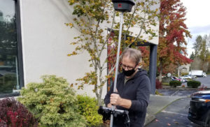 How does a GNSS RTK rover with visual positioning perform in the real world? Gavin Schrock of Geospatial World put the integrated sensor technology to the test.
To talk to one of our experts and learn more about this groundbreaking new solution, please contact us .


