Founded in 2011, Surveyors On Site is a relatively new Canadian firm that punches well above its weight when it comes to landing huge projects—SOS has won bids for survey and layout services for the early works projects that are laying the groundwork for construction of the Gordie Howe Bridge connecting Windsor, Ontario and Detroit, Michigan. When completed, the Gordie Howe will be the first new international crossing in North America for decades, and will likely be North America’s largest infrastructure project in the 2020s.
“I think we’re the only ones here who really appreciate the importance and difficulty of the control network. Everyone else expects it to just work.”
– Christopher Oyler, B.Sc.Eng., OLSGetting these big projects depends largely, of course, on the excellence of SOS’s work on previous smaller projects, and on the expertise they’ve developed in difficult survey specialties. But another factor, according to partner Christopher Oyler B.Sc.Eng., OLS, is the firm’s mastery of a task that is fundamental to all survey work—setting control networks. “We routinely use least squares, redundant field procedures, and the most accurate instruments available to ensure we are setting and maintaining the best control possible. It can seem like mundane or tedious work, but since everything else on a site depends on good control, it’s worth the extra effort to get it right.”
‘An Insurance Policy Where You Actually Get Something’
Work on the Gordie Howe actually began, in a way, with SOS’s work on the Herb Gray Parkway, a $1.4 billion, 11 km extension of Highway 401. “I was largely responsible for most of the layout of 11 of the 12 tunnels on the project,” Oyler explains. “While I didn’t oversee the installation and adjustment of the control point network, I relied on it heavily for the three and a half years I worked on the project. It was this intimate relationship I had with the control and the surveyors who set it that made me uniquely prepared for setting up and maintaining the control point network for the Gordie Howe early works project.”
“The long-term benefit of having a reliable network of points will carry through past the early works portion of the project and well into the actual construction of the span itself.”
– Christopher Oyler, B.Sc.Eng., OLSIt’s fair to call Phase 1 of the early works huge. The site was 250 acres in size, and required the relocation and installation of over 10 km of natural gas pipelines, the construction of a new 5.5 km perimeter access road, and all new water and sewer services, phone, fiber optic, transmission lines, and hydro duct banks. To get this work for SOS, Oyler had to make the pitch of his life to the consultants hired to oversee the project—“I knew I had a couple of hurdles ahead of me; the first was to sell them on the importance of constructing a framework from which all other design and construction related activates would be built; the second was to get them to agree to the cost of this undertaking.”
Oyler’s pitch was simple, but brilliant. He asked the consultants to think of the required control network as an “insurance policy where you actually get something for the premiums paid. The long-term benefit of having a reliable network of points would carry through past the early works portion of the project and well into the actual construction of the span itself.” In the end, he says, “I was able to educate this group of professionals on my area of expertise, and in turn I got the job.”
High Quality Control Network
The Gordie Howe Bridge, when completed, will be 2.5 km (1.6 miles) long and will feature the longest main span of any cable-stayed bridge in North America at 853 metres (2,799 ft). Establishing a control network for such a massive infrastructure project, one that straddles a major river and an international border, is no small undertaking, especially since the network had to also serve the many subcontractors working daily on the slightly more mundane tasks of road building and utility installation, together with all the earthmoving needed on such a site. “I think we’re the only ones here who really appreciate the importance and difficulty of the control network,” says Oyler. “Everyone else expects it to just work.”
“The GS18 T receivers are phenomenal. With the inertial sensors, all we have to do is touch the rod tip to a point, without plumbing, and we have a solid coordinate in half a second. … With HxGN SmartNet RTK available here, they’re great for layout and all the other work we do.”
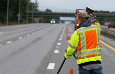
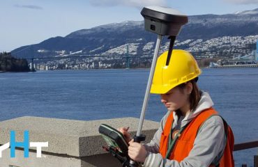
– Christopher Oyler, B.Sc.Eng., OLSTo make the control “just work” Oyler did field work with two Leica Viva TS16 Robotic Total Stations (the 1″ guns mentioned above), a Leica LS15 0.2 mm digital level, and two Leica GS18 T GNSS receivers. He also relied on strict field procedures that emphasized redundancy. “The key ingredient in making this project a success was redundancy. Redundancy takes time, but that’s what it takes to be confident of our calculations and field measurements. Redundancy is what enabled us to fill in holes quickly and efficiently when areas with many control points would be removed, often without any notice.”
The “holes” mentioned are inevitable on a site where excavators, piling rigs, and other equipment are constantly at work. Oyler maintains about 150 control points, and is constantly resetting points that have been damaged, or wiped out entirely. The GS18 T receivers are a big help with this task: they’re accurate, of course, but they’re also fast. “They’re phenomenal,” Oyler says. “With the inertial sensors, all we have to do is touch the rod tip to a point, without plumbing, and we have a solid coordinate in half a second. We have two, and will probably buy a couple more—with HxGN SmartNet RTK available here, they’re great for layout and all the other work we do.”
MicroSurvey’s STAR*NET least squares adjustment solution is also constantly in use. When setting up the control network, Oyler used STAR*NET to adjust 40 different datasets, based on 1,300 different GNSS and terrestrial observations, 1,497 distances, and 4,700 independent measurements. And since that initial work, he’s used it constantly to maintain the network and to manage different orders of control. “With STAR*NET, I can design individual surveys by entering instrument specifications, which computes upper and lower bounds that help us to assess the quality of our work. And it’s superb for post-processing of GNSS surveys—we bring our raw files directly into STAR*NET and processing is extremely rigorous, compared to other programs, when analyzing strength of geometry and other constellation factors.” Oyler is also able to fine-tune the coordinates he publishes for use by other contractors on the site. “Because the site is so big we figure it out by grid, and give an average combined scale factor. But we also have separate control just for actual bridge layout. It’s proven to be the best way to make everything fit.”
SOS’s emphasis on quality surveying makes sense, given the firm’s specialty in control and layout surveying on large, complex infrastructure facilities. Not only is SOS successful in their region, their excellent work has set them up to be part of the international team that will be realizing the largest and most exciting bridge project currently happening in North America. In surveying, and business, quality work always rises to the top.
Image credit: Gordie Howe International Bridge Gallery
To learn how technology can help you build confidence in your control networks, please contact us.


