Whether you’re looking for a new area of focus or a creative way to expand your existing surveying business, this professional’s story can serve as an inspiration.
Vincent T Joachim is a recognized artist and filmmaker, a leader of initiatives for youth empowerment through the arts — and, most recently, a 3D laser scanning specialist for the city of Calgary and the Calgary Police Service. He will be a guest speaker during HDS University 2023, and he has an impressive story with laser scanning as a self-starter.
“Laser scanning creates an immersive 3D world,” Vincent says. “Tackling it was a big jump for me. But I believe in lifelong learning.”
Step One: Look for Opportunities to Learn the Technology
Vincent’s first step into laser scanning came while he served as the photo technician for the City of Calgary, archiving and color correcting crime scene photographs for the Calgary Police Service. When Ken Jones, the training manager for Leica Geosystems’ Public Safety Group, gave a week-long course on laser scanning to the forensic professionals in Calgary, Vincent received an invite.
“I was fascinated by 3D technology,” Vincent says. “I thought of the possibilities of what it could do in police work and crime scene reconstruction.”
Following the in-person instruction, Vincent jumped into learning about the technology through Leica’s online resource library, where he took classes on Leica TruView digital reality viewer, optimizing the use of the RTC360 laser scanner, and much more. To date, he has logged over 120 hours over Leica-provided online material.
“The classes were perfect for me,” he adds. “I was able to watch the videos, pausing and rewinding as needed. I dove in, and I’m now a certified analyst.”
Step Two: Pioneer a New Approach to Deliverables
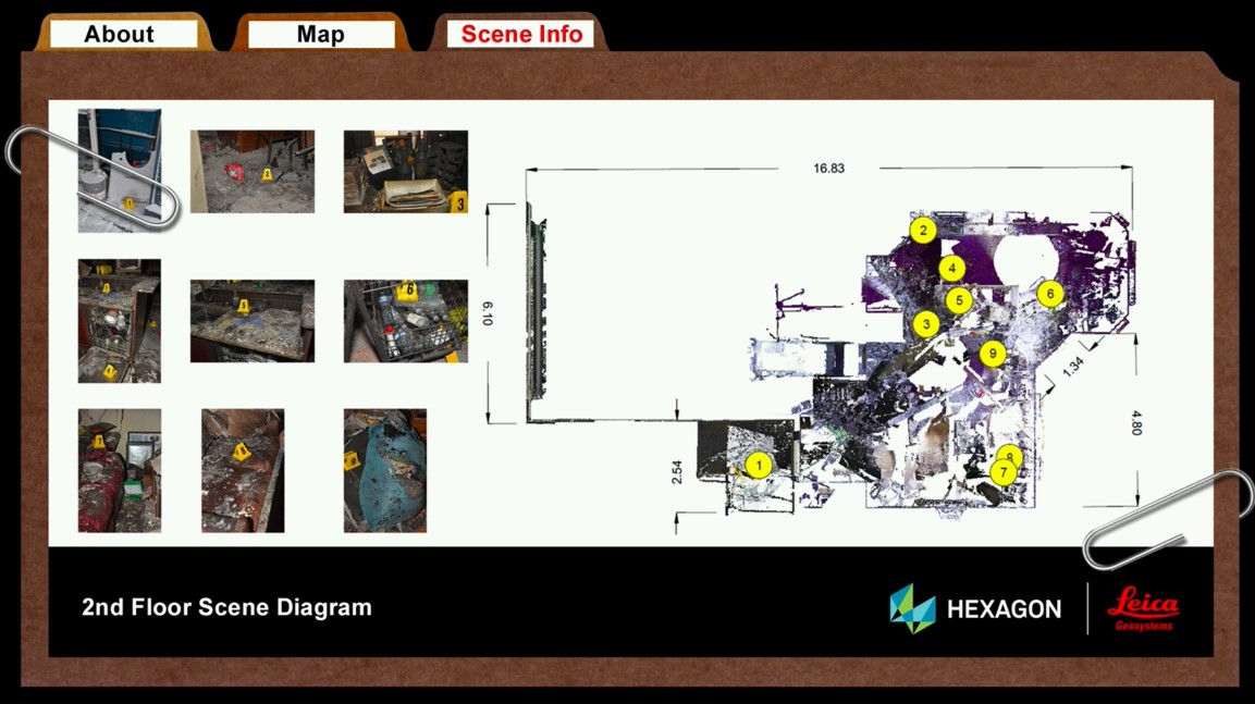
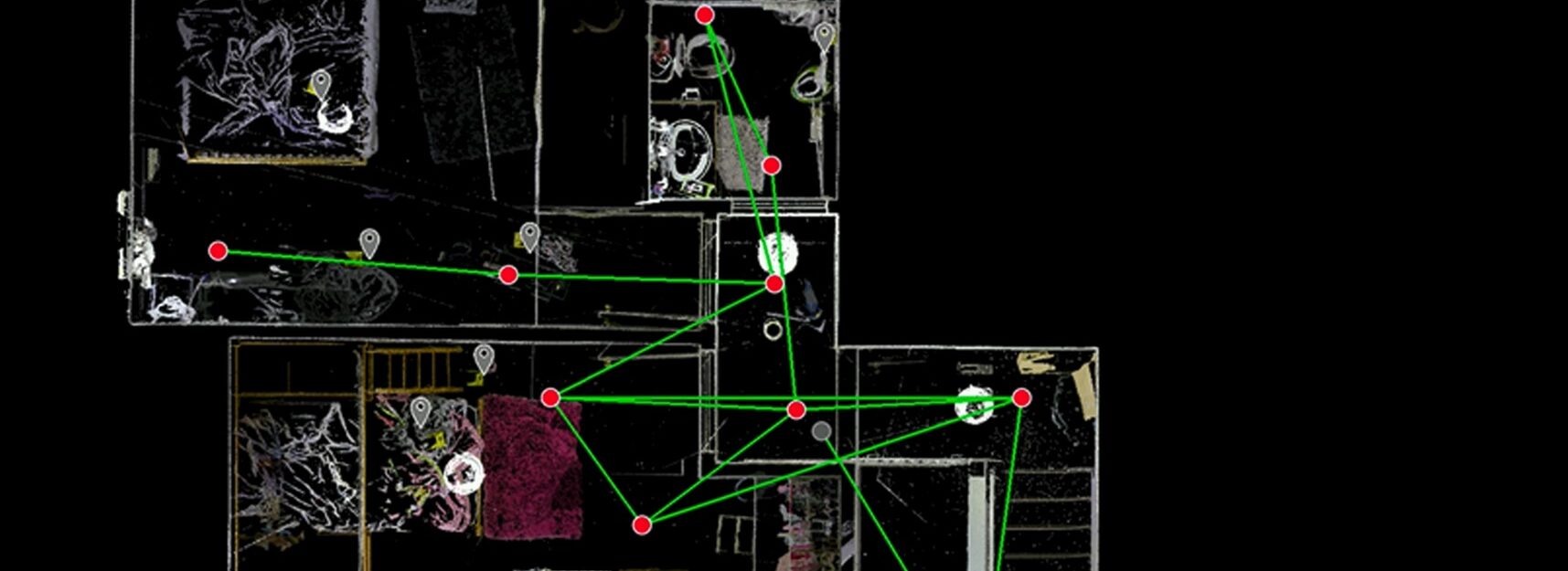
With his new skills, Vincent set out to create a tool for public safety officers that could help the department realize the advantages of the technology. He used the SiteMap capability in Leica TruView software to build virtual crime files that provide intuitive, navigable 3D crime scene reconstructions to investigators, prosecutors, and juries.
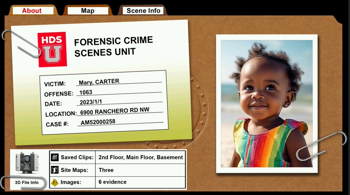
Each file displays relevant information on the crime in the familiar visual of a traditional police file. With a few clicks, a detective or attorney can easily access the 3D point cloud of the crime scene and navigate the evidence files embedded in the point cloud. Even those unfamiliar with point clouds can easily take advantage of the virtual crime scene reconstructions they can provide.


“Instead of having a schematic drawing, I came up with a file system where users can see the picture of the victim,” Vincent explains. “It provides information like the victim’s identity, the date of death, the location of the crime, and the case number alongside the point cloud of the scene. It helps in humanizing the victim so that the investigation goes beyond just looking at numbers.”
Crown prosecutors have found the SiteMaps invaluable, which is leading to increased demand for laser scanning from all stakeholders in the criminal justice system.
Step Three: Pass Along Laser Scanning Knowledge
Now, as the recently appointed 3D specialist for the City of Calgary, Vincent seeks to pass along the knowledge he’s gained from his time with laser scanning.
At HDS University 2023, he will teach classes on how police and public safety departments can use laser scanning to build immersive 3D crime reconstructions that aid in discovering and conveying the events of a crime.
“If I can help out other departments in any way by sharing what I’ve learned, I’m happy,” he says.
Clearly, laser scanning has come a long way since it required a surveyor’s expertise. Today’s technologies are easy to learn and use by anyone in any field. The good news for geospatial professionals is that with a little creativity, there is still plenty of opportunity to develop valuable new applications.
All that’s required is a desire to learn and explore.
To talk to one of our reality capture or surveying technology experts, please contact us.


