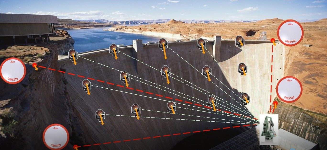
You'll Learn
- Where structural monitoring is used and why it’s needed
- How total station, GNSS and laser scanning advances are improving data collection
- How software advances are providing real-time insights for key stakeholders
- How new apps make it easy to move from surveying into monitoring
Modern construction, infrastructure and natural features in our world require ever increasing attention from surveyors and engineers to keep workers safe, facilitate planning, and prevent disruption of projects. Vigilant and dedicated professionals use a combination of automated instruments, GNSS receivers, laser scanners, radar, geotechnical sensors and other technology to gather geospatial data to support their decision-making processes.
In this 60-minute on-demand presentation, you’ll explore campaign and automated monitoring technology, with a review of considerations involved when deciding to deploy HDS sensors for automated and semi-automated monitoring. You’ll also see examples of the technology in use on recent projects, where it has been combined with traditional monitoring methods to provide optimized solutions.
Watch the presentation now to learn how the latest technology advances can help you optimize your structural monitoring capabilities.
 William T. Derry, Prof. LS, has more than 23 years of experience as a professional land surveyor working with GNSS control, structural layout and general surveying. Trained in the military as a geodetic and artillery land surveyor, Derry has held such diverse roles as project manager, division manager and technology director. Derry currently serves as technical sales engineer for structural monitoring solutions at Leica Geosystems, part of Hexagon.
Note: This presentation was recorded June 2019 and does not include the most recent technology advances, such as the addition of AutoHeight automatic height adjustment to all total stations and the introduction of the TM60 monitoring total station.
To talk to one of our experts and learn more about how to optimize your surveying potential with technology, please contact us.


