Asset monitoring is a growth market for surveyors ready to grasp the opportunity.
It happened with GPS. And GIS. And machine control and (maybe) laser scanning. All these technologies seemed poised for “ownership” by professional land surveyors because of the overlap of professional skills, equipment and work we’re asked to do. And yet, in all these cases, separate professions ended up being largely associated with the solutions we started using first—in some cases, solutions that were proved to be commercially viable by surveyors.
Obviously, many surveyors are using these new technologies, effectively and profitably. But it does seem that our share of these pies could have been much larger, in a way that would benefit both the public and the profession of surveying.
Now another new market is opening up natural opportunities for surveyors and, again, less obviously qualified professions are jumping in faster to take advantage of it. The market is asset monitoring, a practice that is already becoming standard in urban construction and will become routine as the technology becomes more accessible and less expensive, and as cities continue to get more dense, and build upwards. The 2007 collapse of the I-35W Mississippi River Bridge in Minneapolis, and, more recently, the dam failures in Michigan and the condominium collapse in Miami are dramatic examples of the importance of asset monitoring. It’s definitely a growth market.
“Surveyors are already experts in optical and GNSS measurements, and these are the two most commonly used sensors in asset monitoring. And surveyors are also good at analyzing measurement data and preparing reports … and that’s asset monitoring, in a nutshell.”
The Definition of Monitoring
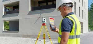
“Monitoring” is a broad term, of course. In this context, I’m referring to the use of several diverse measuring sensors, some permanently installed, along with specialized software, to monitor the real-time movement of infrastructure assets like buildings, bridges, dams, large earthworks, tunnels, and sewers.
Defined this way, it’s apparent that surveying firms are a natural choice for this specialty. Surveyors are already experts in optical and GNSS measurements, and these are the two most commonly used sensors in asset monitoring. More specialized equipment, like strain gauges and inclinometers, are also used but are easier to apply than, say, robotic total stations. And surveyors are also good at analyzing measurement data and preparing reports … and that’s asset monitoring, in a nutshell. Our field experience is a plus, as is our courtroom experience, given the potential for expert witness work in asset monitoring.
Where are the Surveyors?
I estimate that about 50 U.S. firms have made asset monitoring a viable specialty. Some are traditional survey firms, like New York’s TECTONIC Engineering & Surveying Consultants. But so far, the two professions most commonly represented in this niche, in my experience, are geotechnical engineers and structural engineers.
That said, there are signs that surveyors are waking up to the opportunities. Most of the land surveying conventions I’ve attended over the last year have featured a panel or section on monitoring, and that’s a good start. An excellent next step would be for surveyors to take the initiative and start assembling standards and best practices for asset monitoring. The field is still wide open here; some agencies, like CalTrans, have written standards, and there have been a few magazine articles on the topic. But there is still a lot of work to do—specifications, for example, are often unrealistic or not broadly applicable to different types of structures, and there are not yet widely accepted formats for reporting, analyzing, and publishing (as alerts, say) monitoring observations.
Asset monitoring is here to stay, and it’s only going to get bigger as the technology improves and the need expands. Land surveyors are already expert in most of the techniques used in asset monitoring. With a focus on this market, this expertise can be translated into significant ‘market share’ so that, someday, when an owner or agency realizes they need help with a monitoring situation their first thought will be, “Better call a surveyor!”
To talk to one of our experts and learn more about solutions for surveying and monitoring, please contact us.


