Should you use total stations or GNSS for your monitoring project? This brief overview can help you decide.
Asset monitoring with total stations is more common and better known than monitoring with other spatial sensors, and for good reason—total stations are a great choice in most situations, given their ability to monitor up to hundreds of points from a single setup, in real time and with high accuracy. But GNSS monitoring also has its place. In fact there are many challenging monitoring projects that require the special capabilities of GNSS receivers, sometimes by themselves and sometimes in combination with total stations.
We can think of these special GNSS capabilities as falling into two categories—real time and long term.
Real Time Monitoring
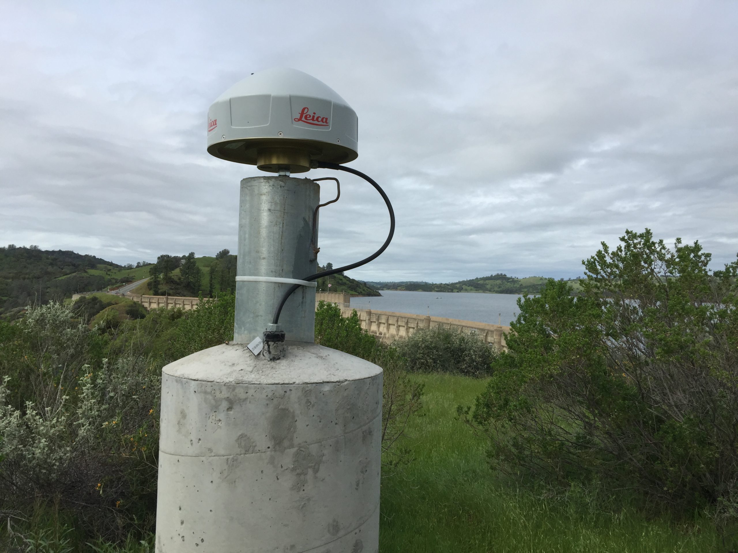
Real time monitoring is often performed with total stations when a large number of points need be measured, but GNSS is better in specific situations. For example, where just a few points need to be monitored, as on a dam, GNSS receivers can be the better choice because they work in all weather (total station monitoring can be shut down by fog, rain, or snow), they don’t require long lines of sight to ground-based control, and they update 3D position continually without needing to reference other earthbound points.
 “Real time monitoring at high speed is a specialty of GNSS; for example, the sway of a bridge at mid-span can be tracked at positional movements up to speeds of 50 Hz so accurately that we can tell when a large truck is crossing the bridge and which direction it is headed.”
– Craig Hewes, PLS
A real life example that comes to mind is a pipeline monitoring system I helped design. This system crossed over a deep valley and river, with support structures set unavoidably in permafrost. Just a few points needed to be monitored, in near real time, to detect any long term instability or rapid thawing. Reliable long sight lines were not available, because most of the surrounding area was also permafrost. And losing 3D positioning capacity in extreme weather could be a real problem; after all, heavy rains or snow loads are a precipitating factor for land movement.
We ended up setting a total of nine receivers—seven on the pipe and two on permafrost as bases. This provided real time data of sufficient quality to protect against rapid failure and give operators ways to head off problems while also providing data on slower movement over years or decades.
Real time monitoring at high speed is also a specialty of GNSS; for example, the sway of a bridge at mid-span may be tracked at positional movements up to speeds of 50 Hz so accurately that we can tell when a large truck is crossing the bridge and which direction it is headed.
Long Term Monitoring
Long term monitoring is also well suited for GNSS. In fact, monitoring with receivers may be at least as common as total station monitoring for assets like dams, bridges, land slide areas, and open pit mines, where rapid catastrophic failure is not expected, but knowledge of relatively small movement over months can be valuable. Offshore drilling platforms are a great example; they rarely fail quickly, but monitoring movement compared to the seabed can be incredibly useful for operation and safety. And without stable backsights available off-platform, total stations are not of much use. Since real time feedback on position is not so critical on projects like this, adequate information can usually be provided with just a few receivers acting as rovers, without the support of an RTK network.
Other Applications
Another interesting use of GNSS receivers in monitoring networks is when co-located with total stations as a positional check. For example, in a landslide monitoring situation, where a total station might have to be placed in a location that is itself unstable, a prism-mounted receiver can be placed nearby and included in the total station’s monitoring routine. This provides an excellent check on absolute position of the occupied point and the overall network. Because they are very accurate clocks in addition to being good spatial sensors, GNSS receivers are sometimes used to provide timing for sensors like accelerometers.
GNSS monitoring is becoming even more practical as monitoring-optimized receivers become available. Leica Geosystems has about five receivers particularly suitable for monitoring, with features like low power consumption and integrated antennas. Some are quite basic, and cost-effective in straightforward monitoring systems—you don’t have to pay for more sophistication than is needed.
A final point is that the effectiveness of a GNSS monitoring system is only partially dependent on the quality of the actual receivers; the overall design of the monitoring routines and administrating software is at least as important. Ideal applications will have good routines for both real time and post-processed solutions; will publish alerts automatically via email, web, and texting; and will include data from available RTK networks and/or high quality reference stations. Leica Geosystems’ GNSS Spider is an example of a system that offers these capabilities.
In short, if asset monitoring is part of your firm’s business plan, don’t automatically assume that total station monitoring is the way to go. In many cases, monitoring networks that include, or are wholly composed of, GNSS receivers are the most appropriate and most cost-effective solution.
About the Author:
 Craig S. Hewes, PLS, is a licensed land surveyor who is experienced in supertall building construction and asset monitoring. For nearly 15 years, Craig served as Leica Geosystems' director of monitoring for the Eastern US and Canada. In his current role as Leica Geosystems' senior strategic account manager, Craig helps surveying and engineering organizations achieve new levels of success through a strategic partnership approach to technology adoption.
To talk to one of our experts and learn more about solutions for surveying and monitoring, please contact us.


