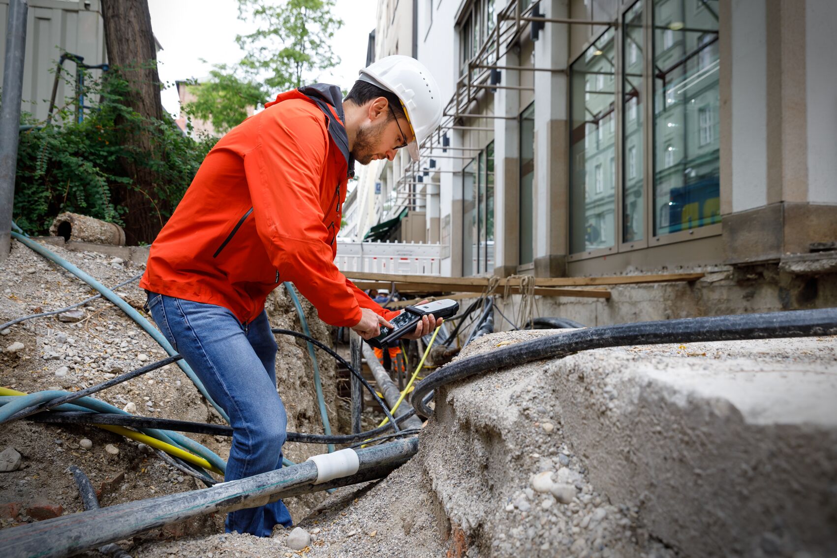
Are your field crews and utility inspectors collecting asset data in the easiest way possible? Here are eight reasons why BYOD is the future of GIS.
Bring-your-own-device (BYOD) is the future of geographic information systems (GIS). Intuitive, real-time maps with centimeter-accurate measurements provide considerable value in regards to asset tracking and management, but the process to create those GIS resources can be time consuming, expensive, and tiresome. Bring-your-own-device solutions that pair devices with smart antennas can improve the user experience, streamline workflows, and maintain exceptional accuracy during mapping.
Here are eight reasons why BYOD is the future of GIS.
1. Accurate and Real-Time Data Collection
With the use of a smart antenna like the Leica Zeno FLX100, users can map spatial data with down to one centimeter of accuracy. Through a cloud connection to a GIS server, that data can be updated in real-time or near-real time, helping to ensure that all stakeholders are working off of the same information.
2. Intuitive Software Driven by User Experience
By operating through an application on a smartphone or tablet, users creating maps with a BYOD strategy are freed from hassling with overly complicated software. A companion measuring app like the Zeno Mobile is designed to allow for easy data capture. Because of the intuitive setup, even people new to the application are able to unlock its advanced functionality — training on new equipment like a smart antenna and accompanying mobile app often only thirty minutes, if not less.
3. Speedy Setup and Use
Smart antennas like the FLX100 are designed to connect to devices over Bluetooth so that users can begin taking measurements as quickly as possible. Surveyors connect their device to the antenna and then begin mapping data right away. And since the application can run a host of data capture functions simultaneously and pair with other sensors (like laser rangefinders and cable locators), the spatial data captured on a single site visit is maximized. During use, importing and exporting data is as simple as connecting to the Cloud and streaming data to the base station for real-time asset tracking and collection, while still allowing for QA/QC to be easily performed on the back end.
4. Precise Measuring in Demanding Environments
BYOD data mapping only takes a device and a smart antenna, which allows for precise data capture in even the most demanding environments. The portability allows users to capture point, lion, and polygon data wherever they are trying to measure, and smart antennas like the FLX100 are made to be compact, lightweight, and resistant to dust and water.
5. Seamless Integration with Third-Party Software and Cloud Services
Leica Geosystems’ solutions integrate seamlessly with Esri GIS software and other third-party solutions. Software like Esri ArcGIS unlocks the full potential of GIS data capture, displaying data intuitively for stakeholders. This creation of user-friendly maps enables entities to maintain and track their assets, better allocate resources, and help project costs for work.
6. Maximized Efficiency
Troubleshooting clumsy and complicated equipment on site can consume time that would be better spent on mapping assets. The simplicity of a smart antenna along with the user experience of a mobile data capture app keeps the need for that troubleshooting extremely low. And if there is an issue with the smartphone or tablet, the smart antenna can easily be connected to another device, avoiding the hassle of managing product licenses and taking time away from data capturing. Surveyors can survey more, and managers can redirect time that used to be spent troubleshooting into helping their teams utilize GIS even more efficiently.
7. Proven Results
A BYOD model has already been embraced by numerous entities, such as the City of Saratoga Springs in Utah, to make more informed decisions, cut project times, and streamline workflows. Even cities that have been using GIS for years and are well-acquainted with its value have been able to further enhance their investments with a BYOD strategy.
8. Informed Decision Making
GIS spatial data collected quickly and displayed in real time enables decision makers to choose how to best invest time and money by relying on accurate measurements of assets. But with the wrong workflow, creating GIS resources can become bogged down by inefficient mapping processes, user error due to unintuitive software, and laborious data-sharing processes. A lean BYOD workflow, such as one built around the FLX100, helps eliminate those inefficiencies and open up a cost-effective GIS strategy for those who may not otherwise have considered it.
About the Author
 Jason Hooten has nearly 20 years of experience in the GIS/mapping and surveying industries. As GIS sales and support manager for Leica Geosystems in the U.S. and Canada, Jason guides companies in identifying and implementing solutions that simplify GIS field data collection and optimize asset intelligence.
To talk to one of our experts and learn more about GIS asset collection or other ways to optimize your surveying and mapping potential, please contact us.


