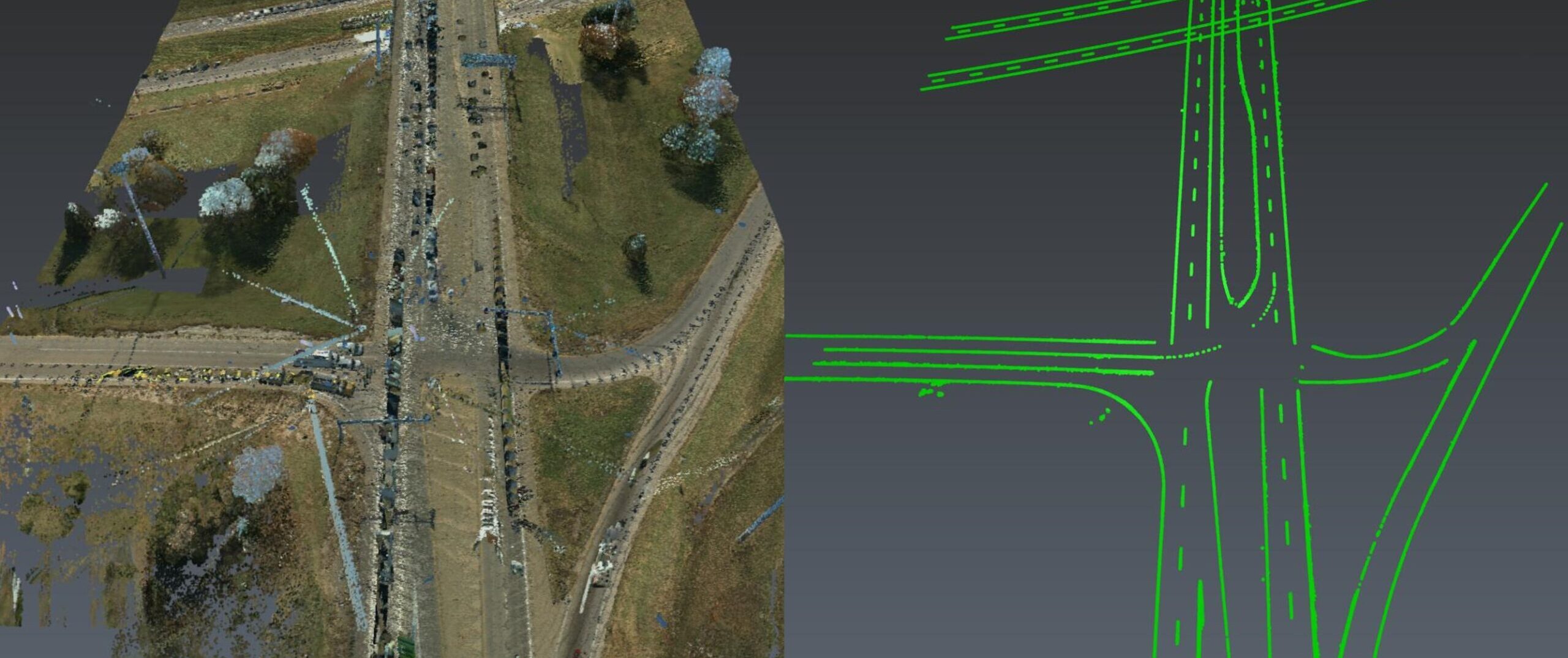
Join Kyle Palmer to learn how to create your own software tools that do exactly what you need, so you can have a fast and simple end-to-end solution that is fully within your control.
ON DEMAND
One of the biggest challenges when working with point cloud data is finding the right topographic data extraction tools you need for every project. Exporting to different software packages is time-consuming and cumbersome. If only there were a single software program with all the right tools tailored to your working style and your project requirements- life would be perfect.
With Cyclone 3DR, you can create your own tools that do exactly what you need, giving you a fast and simple end-to-end solution that is fully within your control.
In this 60-minute webinar, reality capture and mobile mapping expert Kyle Palmer will show you how to use the power of scripting to quickly extract data from any point cloud, from any sensor using finely tuned workflows that produce a deliverable more efficiently than generic tools.
Using paint stripe extraction as an example, Kyle will demonstrate how to write, apply, and test a script that will deliver reliable, repeatable results in minutes.
You'll Learn:
- How to tap into hidden skills you probably already have on your team
- How to create data extraction tools that are hyper-specific to your needs
- How to gain a competitive edge and grow your business by taking control of your topographic data extraction workflows
Whether you’re working with data from drones, mobile lidar, tripod laser scanners, or any combination of sensors, this webinar will give you powerful new insights.
Watch the webinar now to discover how to break free from the constraints of your software and achieve high-quality deliverables at a speed you never thought possible.

Kyle Palmer, RPLS, began his career as an instrument operator and survey crew chief before finding his calling in reality capture. After 15 years of working with lidar data, Kyle is relieved to finally have access to technology that streamlines the entire workflow, and he’s thrilled to be able to share his expertise with other surveying and mapping professionals. As mobile mapping consultant for Leica Geosystems, Kyle assists private firms and public agencies of all sizes in their mobile mapping journey. Follow Kyle on LinkedIn.
To talk to one of our experts and learn more about how to optimize your surveying potential with technology, please contact us.


