Customer-driven innovation and seamless collaboration between two popular software packages are transforming survey workflows, addressing industry pain points, and empowering surveyors to work smarter and faster.
Surveying workflows have traditionally been a juggling act, requiring surveyors to navigate between multiple tools to collect, process, and adjust data. This fragmented process often leads to inefficiencies, reduced productivity, and unnecessary complexity.
Recognizing these challenges, Leica Geosystems’ U.S. and Canada Software Development Center (SWDC) recently introduced an integration between Leica Infinity and MicroSurvey StarNet that provides a practical solution. By enabling surveyors to leverage StarNet’s robust least squares adjustment capabilities alongside Infinity’s advanced data visualization tools, this integration offers a flexible and incremental approach to improving workflows without disrupting existing processes.
As a result, firms are simplifying tasks, enhancing flexibility, and driving innovation.

Why the Integration Was Needed
Historically, surveyors have relied on separate tools for different tasks, leading to common pain points.
Outdated QA/QC Procedures
While StarNet excels at least squares adjustments, it is not designed to modify or update advanced data collection methods, such as tilt-corrected GNSS or total station measurement data. This data needs to be verified in Infinity before being adjusted in StarNet.
Fragmented Workflows
Processing data in StarNet from advanced field software such as Leica Captivate can be done through an importer, but users are limited in reviewing the data or applying corrections to it.
User Adaptation Challenges
Transitioning to new software, such as Leica Infinity, poses hurdles for teams accustomed to StarNet’s flexibility with text-based data editing.
Customer feedback highlighted the need for a solution that combined the strengths of both software packages while allowing surveyors to transition at their own pace.
Step-by-Step Workflow Enhancement
The integration between Leica Infinity and MicroSurvey StarNet addresses these challenges head-on, creating a streamlined and user-friendly workflow.
1. Data Collection with Captivate:
Field crews use Leica Captivate to collect robust datasets, including imagery, point clouds, and line work. Captivate’s advanced capabilities ensure high-quality data from the start.
2. Processing in Leica Infinity:
Once the data is imported into Leica Infinity, surveyors can visualize and perform QA/QC checks on their datasets. Infinity’s ability to handle complex datasets provides a powerful platform for processing and analysis.
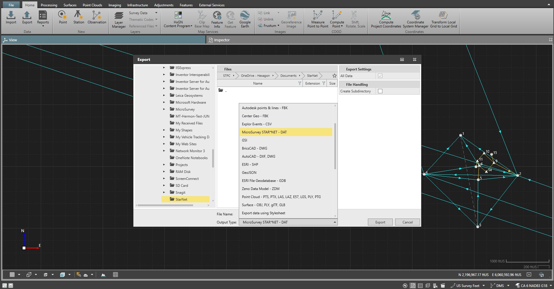
3. Exporting to StarNet:
For surveyors familiar with or required to use StarNet for least squares adjustments, Infinity now offers seamless data export. This allows users to perform adjustments in StarNet while maintaining their preferred workflows.
4. Updated Control in Infinity:
After adjustments are finalized in StarNet, control coordinates can be used in Infinity to automatically update all additional measurement data before developing a final deliverable directly in Infinity or exporting the data to CAD. This streamlined process eliminates unnecessary steps and ensures data accuracy.
The software integration empowers surveyors to gradually adopt Infinity’s full capabilities while maintaining flexibility with StarNet. It’s a win-win approach for both seasoned users and teams transitioning to new workflows.
Broader Collaboration for Enhanced User Experience
The seamless integration between Leica Infinity and MicroSurvey StarNet is more than a technical achievement—it’s a testament to the power of collaboration and customer-driven innovation.
Leica and MicroSurvey Collaboration
As sister companies under Hexagon, Leica Geosystems and MicroSurvey worked together to address surveyors’ needs. By combining Infinity’s advanced visualization and processing capabilities with StarNet’s trusted adjustment tools, they created a solution that enhances productivity without disrupting existing workflows.
User-Centered Innovation
This integration was driven by feedback from surveyors who sought a solution to bridge the gap between field data collection and office processing. By listening to their needs, Leica Geosystems SWDC developed a workflow that simplifies tasks while allowing gradual adoption of new tools.
Flexibility for Surveyors
The integration allows surveyors to choose their preferred tools while unlocking Infinity’s full potential. Whether meeting state reporting requirements in StarNet or leveraging Infinity’s visualization capabilities, users can tailor workflows to their unique needs. This solution has proven invaluable in scaling operations, improving productivity, and delivering excellence on complex projects.
Customer-Driven Innovation
The integration between Leica Infinity and MicroSurvey StarNet is just one example of how customer-driven innovation from the Leica SWDC is transforming survey workflows. By addressing pain points, simplifying tasks, and enhancing flexibility, the Leica SWDC empowers you to work smarter, not harder.


