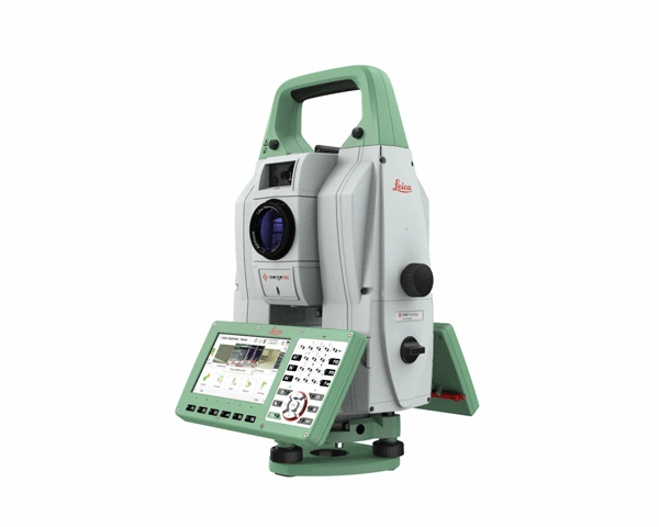
When the first MultiStation, the MS50, appeared on the market in 2013, the fast, high-precision total-station-laser-scanner-combo was considered revolutionary for it’s ability to provide scanning capabilities in a traditional survey workflow. For many surveyors, it opened new doors of opportunity working with 3D point clouds. The next-generation MS60, introduced a few years later, simplified linework, coding and 3D visualization through the Captivate touch-technology field software. Now Leica Geosystems has released a new version of the MS60, and surveyors are taking notice of the advances. (Related: See what surveyors are saying about the versatility of a MultiStation.)
The instrument’s one-second angle accuracy and 2,000 meter reflectorless range are now augmented with a fast scan speed of up to 30,000 points per second, which allows you to quickly complete scans with dense scanning grids. Optimized scanning paths and more control over scanning functions enables you to significantly reduce total scanning time. And you don’t have to spend time adjusting the instrument height—AutoHeight does it for you with a single button press.
“I’m in love with the AutoHeight feature. Awesome to see it incorporated into this product line.”
– Jeff J., on LinkedInInstead of returning to the office to check data, you can compare measurements to design data in the field with the new Leica Captivate Inspect Surface app for an additional productivity boost (see below).
These advances make the new MS60 faster at completing measurement and stakeout-related tasks than any other scanning total station while giving you the flexibility to handle a wide range of survey-related applications. “Scan data combined with traditionally measured points, whether it’s from the total stations or the GPS receivers, is one of those immediate deliverables that help our clients see what we’re doing. With the scan data of the Leica Nova MS60 MultiStation, we can graphically show—the same day it is collecting—the locations in the field to any person,” said Donald Smith, senior land surveyor and principal at BL Companies. “When you deliver on time and provide customers with a deliverable they can see, you’ve just got yourself a recurring client.” (See how BL Companies increases value with point clouds.)
Wondering what makes the new MS60 so much faster at scanning and how that could impact your work? Richard Ostridge, senior product engineer, explains in this interview.
To find out whether a MultiStation would be a good fit for your needs or to request a demo, please contact us.