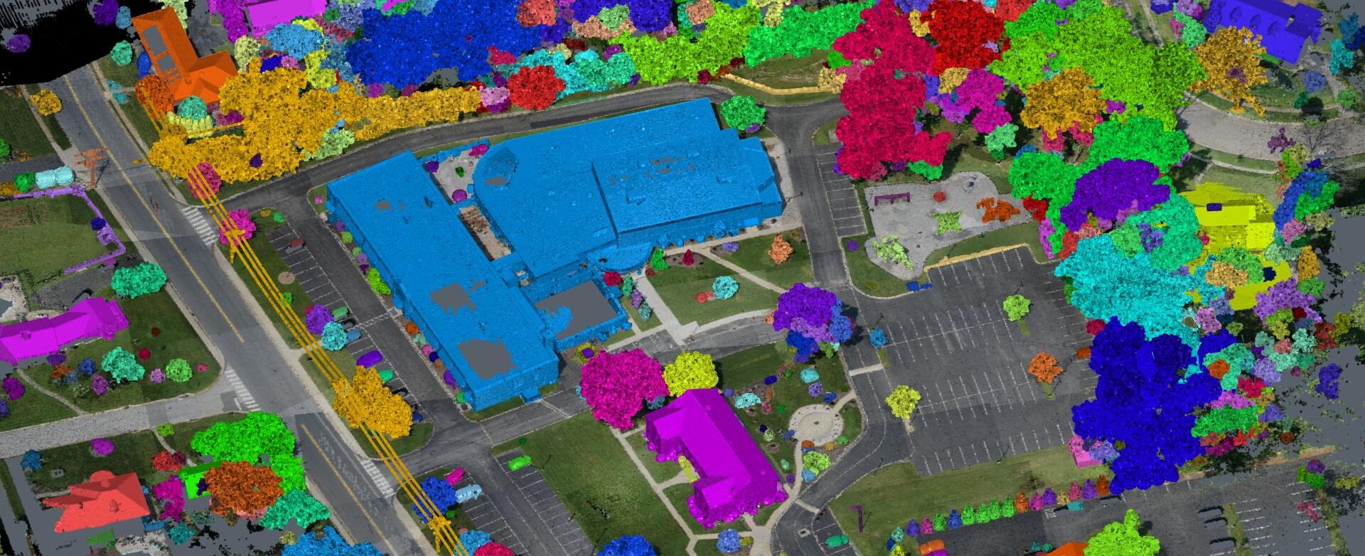
Join Seth Gulich to see how easy it can be to go from field to finish with your drone data using Cyclone 3DR software.
AVAILABLE ON DEMAND
If you’re one of the many surveyors and engineers who have started using drones in your projects, you’ve probably been frustrated by the workflow. It’s not uncommon to have to spend hours or even days using several different pieces of software to classify and clean the data, generate surfaces and linework, and compile the surfaces and linework in a CAD software so it can be merged with conventional survey data.
There is a better way.
Leica Cyclone 3DR is a single software package that streamlines and simplifies the process of taking drone data from the field to the final survey deliverable. In this interactive 60-minute webinar, Seth Gulich will show you the tips and tricks other surveyors and engineers are using to supercharge their drone surveys.
You'll Learn:
- How to quickly clean data using built-in filtering tools
- How to eliminate entire steps with auto classification
- How to rapidly generate surfaces and 3D models, then simplify them for direct import into a CAD platform
- How to create data cross sections and compare surface models to the original point clouds for rock-solid QA/QC
Watch the webinar now to see what you’re missing and how much time you can save when working with drone data.

Seth Gulich, PSM, has nearly 10 years of experience in surveying field and office work, business development, training, project management, and workflow optimization. Working his way from intern to technician to project surveyor, Seth was always curious about the opportunities for LiDAR and drones. After earning his FAA Part 107 Pilot Certificate in 2018, he developed the unmanned aircraft system (UAS) program for Bowman Consulting. He also led the implementation and use of terrestrial and mobile LiDAR applications on projects in the state of Florida and the southeast for Bowman. Since January 2022, Seth has served as an adjunct lecturer for Penn State’s Surveying Engineering program teaching a variety of course work, such as Photogrammetry, State Plane Coordinate Systems and Map Projections. As a reality capture consultant for Leica Geosystems, part of Hexagon, Seth draws on his rich technology background to guide surveying, mapping, and engineering professionals in achieving high productivity and a fast ROI on their technology journey. Follow Seth on LinkedIn.
To talk to one of our experts and learn more about how to optimize your surveying potential with technology, please contact us.


