Innovative Leica Pegasus TRK technology enables small firm to provide big value to a wide range of clients throughout the Midwest.
“With the mobile mapper, we’re achieving a lot more with fewer people compared to larger firms. Many people are surprised to discover we are a 25-person team with the amount of service we offer.”
—Russell W. Falconer, Principal, Civil Engineer
At a Glance
- R.W. Engineering & Surveying Inc. is a 25-person civil engineering and land surveying firm based in Omaha, NE.
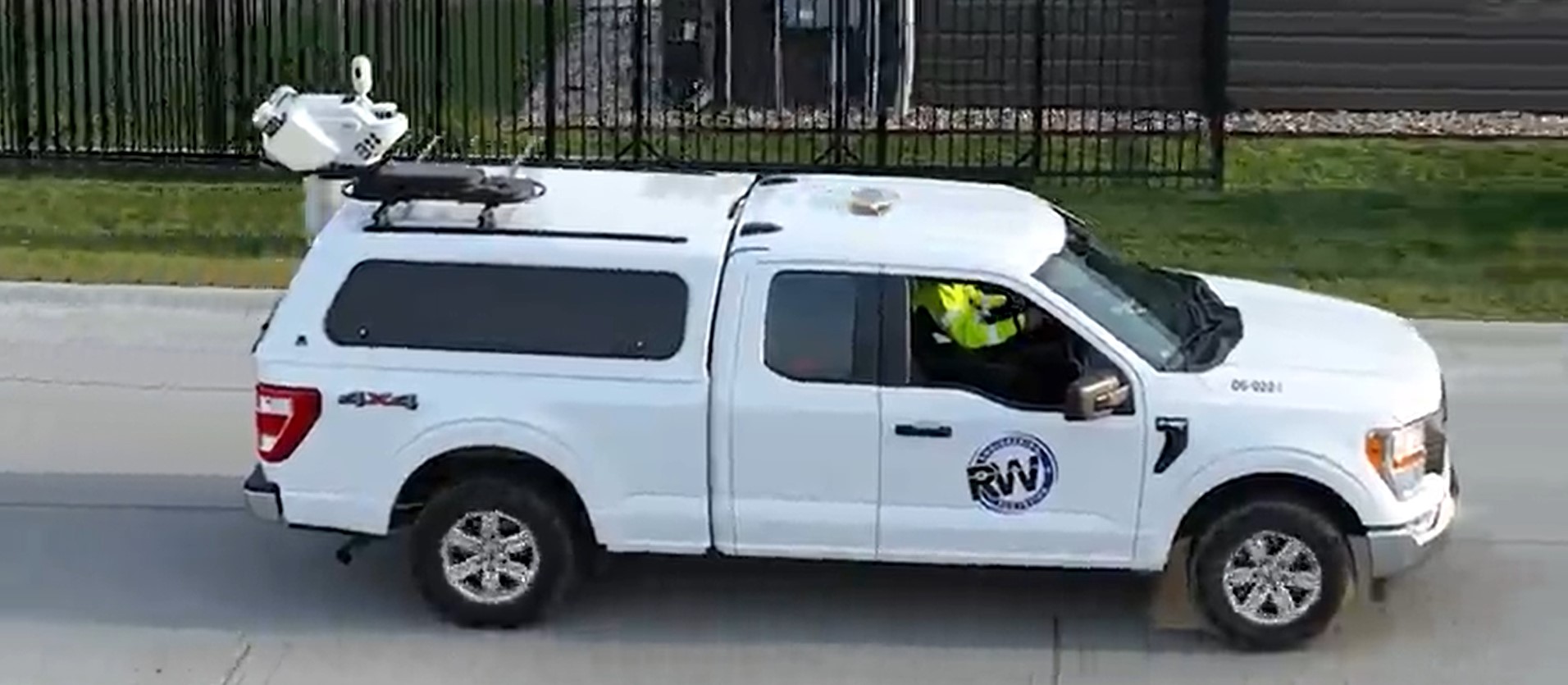
- Following the strategic hire of a 3D scanning coordinator in the summer of 2021, the company quickly grew its reality capture capabilities, culminating in the purchase of a Leica Pegasus TRK700 mobile mapping system in the winter of 2023.
- With mobile mapping, R.W. Engineering & Surveying has improved safety by reducing the number of staff working in or near roadways.
- The volume of data the firm collects with the Leica Pegasus TRK shortens the duration of out-of-town projects and accelerates project delivery, which improves work-life balance for surveyors while increasing client satisfaction.
- The built-in automation and artificial intelligence of the TRK gives R.W. Engineering & Surveying the capacity to expand their services and geographic footprint without overburdening existing staff.
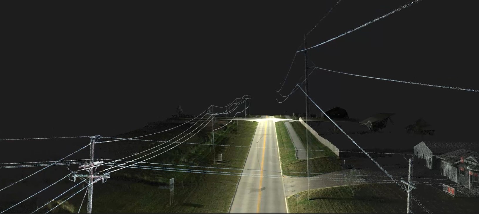
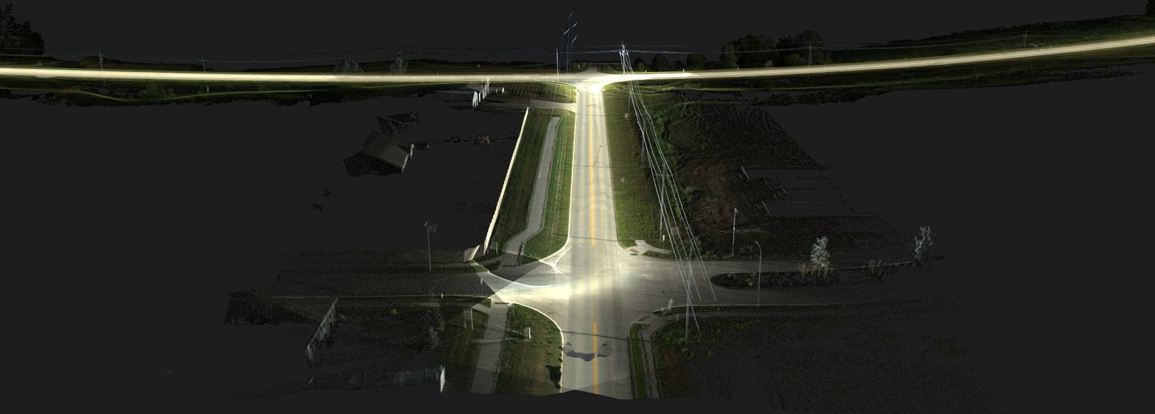
“Whenever I present point cloud videos as exhibit drawings to our clients during business development meetings, the response has been overwhelmingly positive. People are impressed by both the volume and quality of data collected by the TRK mobile mapper. The level of detail is striking, with the ability to see every small feature, such as trees, captured by the mapper.”
—Brian L. Yentes, Vice President Land Surveyor
Company Overview
R.W. Engineering & Surveying Inc. is a 25-person firm based in Omaha, NE, that offers civil engineering and land surveying services as well as aerial mapping, construction contract administration, 3D machine controlled modeling, geographic information systems (GIS) and 3D laser scanning.
Licensed to survey in Nebraska, South Dakota, Kansas, Missouri, Iowa and Minnesota, the company caters to clients ranging from state departments of transportation to private consultants and handles projects from long linear corridors to urban development.
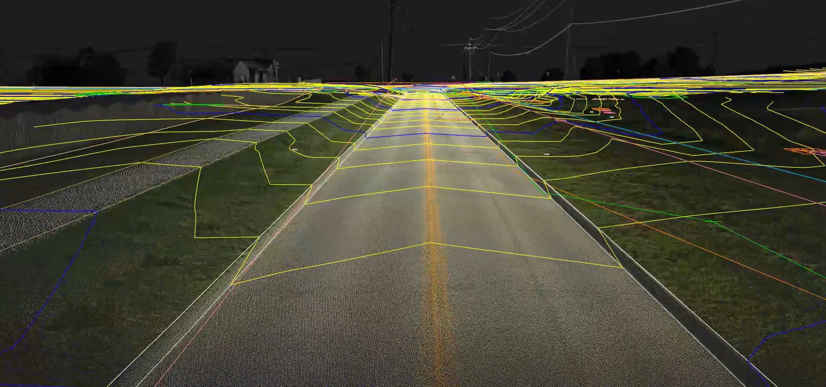
“A two-person survey crew would need hundreds of hours to cover 25 miles of a roadway topographic survey. That’s a lot of man-hours on the road, where a moment’s distraction could lead to an injury or even a fatality. Using the TRK700 mobile mapper, we dramatically improve our safety profile by reducing the risk to personnel.”
—Brian L. Yentes, Vice President Land Surveyor
Digitization Challenge
Skilled at traditional approaches to surveying, R.W. Engineering & Surveying began outsourcing an increasing amount of work that required 3D laser scanning capabilities. In 2021, the company made a strategic decision to hire a 3D scanning coordinator and build an in-house team that could provide reality capture services.
Under the leadership of Andrew Pokorny, LSIT, the team quickly grew their capabilities with terrestrial stationary laser scanning and total station scanning, but they were still facing challenges. Large projects often required surveyors to spend months away from their families, which put a strain on their staff. The need for surveyors to work in and around roadways presented significant safety concerns. And, after decades of being on the Nebraska DOT on-call list for surveying work, the firm suddenly found themselves excluded—because they didn’t have mobile lidar capabilities.
Seeking to boost efficiency in a labor-strapped market, the company sought a mobile mapping solution that could shorten project times, deliver accurate and comprehensive data, and integrate easily into their existing scanning workflow.
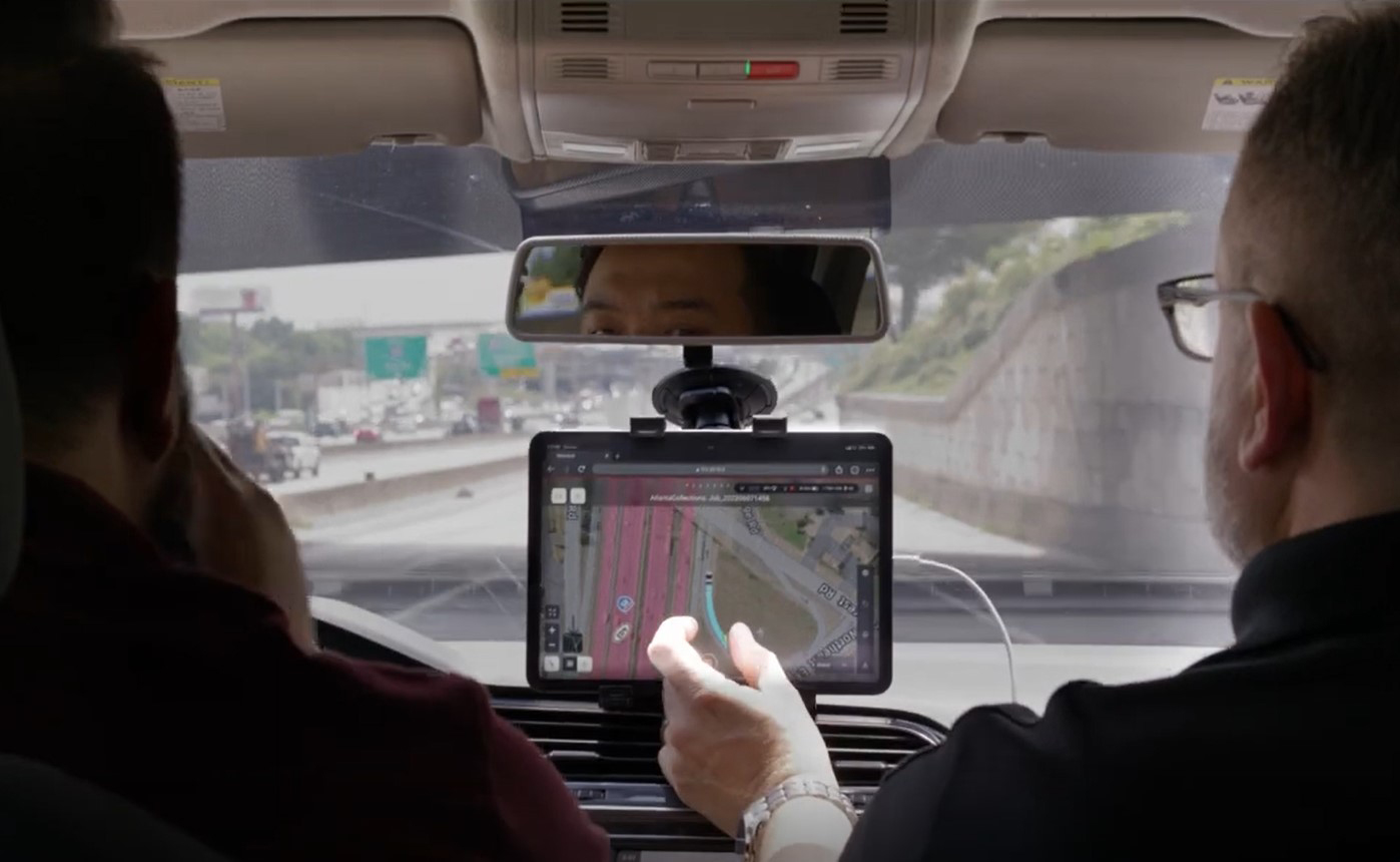
“The simplicity of the hardware and software for the TRK700 allows us to easily train multiple people on it, ensuring redundancy in knowledge. If someone is sick or leaves the company, we have several trained individuals who can operate the device. This approach is more efficient and ensures continuity on our projects.”
—Brian L. Yentes, Vice President Land Surveyor
High-Value Mobile Mapping Solution
After evaluating other mobile mappers, R.W. Engineering & Surveying invested in the Leica Pegasus TRK700 mobile mapping system. In addition to its ability to capture minute details with every scan while driving at roadway speeds, the team was impressed with the mapper’s compact size and streamlined backend software, powered by automation and artificial intelligence. The simultaneous localization and mapping (SLAM), GPS, and IMU all work together in an efficient workflow without the need for files to be moved across a host of applications. Additionally, the system is easy to learn and use, making it possible to cross-train employees to provide the skill redundancy required for a lean operation.
As a result of the investment, R.W. Engineering & Surveying provides clients a fast turnaround on comprehensive deliverables at a quality and scale of service that matches or exceeds what is offered by much larger engineering and surveying firms. They’ve shortened project durations from weeks to days and improved safety, which boosts work-life balance and employee morale. And they’re growing, expanding their services in states throughout the Midwest.
“We’re small and scrappy. We’re quick to respond and quick to get work done. I would challenge anybody to find a company of our size that is adopting these technologies at such a rapid rate and using them in their everyday workflows.”
—Brian L. Yentes, Vice President Land Surveyor
To talk to one of our experts and learn more about mobile mapping or other ways to optimize your surveying potential, please contact us.

