

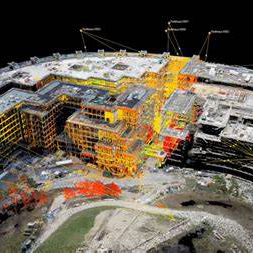
 The Easiest Way to Add Laser Scanning to Your Surveying Capabilities
>>WATCH ON-DEMAND
>>DOWNLOAD THE PDF SUMMARY
From multistations and scanning total stations to portable and easy-to-use laser scanners, the technology landscape is both intriguing and confusing. This on-demand webinar answers the most common questions about laser scanning and gives you the insight to make an informed decision. You’ll learn:
- The difference between a multistation and a scanning total station
- What to look for in a total station with laser scanning capabilities
- When to use a scanning total station vs. a dedicated laser scanner
- What to expect from field and office software
- How to use point clouds to grow your business
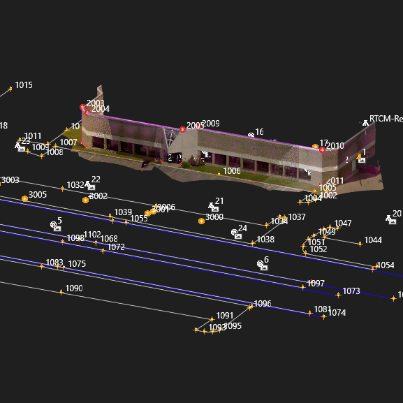 A Surveyor’s Guide to Using Point Clouds in CAD
What’s the best way to integrate point cloud datasets with linework to create a high-value deliverable? With software plugins, you can easily work with large point clouds directly in your CAD system. This on-demand webinar takes you from data capture to deliverable using a Leica MS60 MultiStation with Leica Captivate, Infinity and CloudWorx to show you how to achieve seamless data transfers, full data traceability and efficient, effective drawings and models. You’ll learn:
- How to verify the quality of your data, correct errors and generate reliable reports to minimize your risk
- How to use imaging to create missing points from pictures
- How to use point clouds and imaging to save time in the field and the office
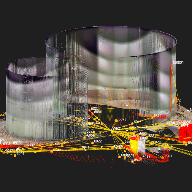 A Surveyor’s Guide to Maximizing the Value of Point Clouds
Full-scale point cloud management with automated point cloud analysis and modeling is easier than you think. This on-demand webinar takes you from data capture to deliverable using a Leica MS60 MultiStation with Leica Captivate, Infinity and Cyclone3DR software to show you how to achieve seamless data transfers, full data traceability and compelling 3D deliverables and reports. You’ll learn:
- How to verify the quality of your data, correct errors and generate reliable reports to minimize your risk.
- How to use intuitive yet powerful point cloud management tools to automate common tasks and deliver actionable information.
- How to maximize the use of point clouds in your work and deliverables to provide the highest return on investment for you and your clients.
To talk to one of our experts and learn more about how to grow your surveying business, please contact us.


