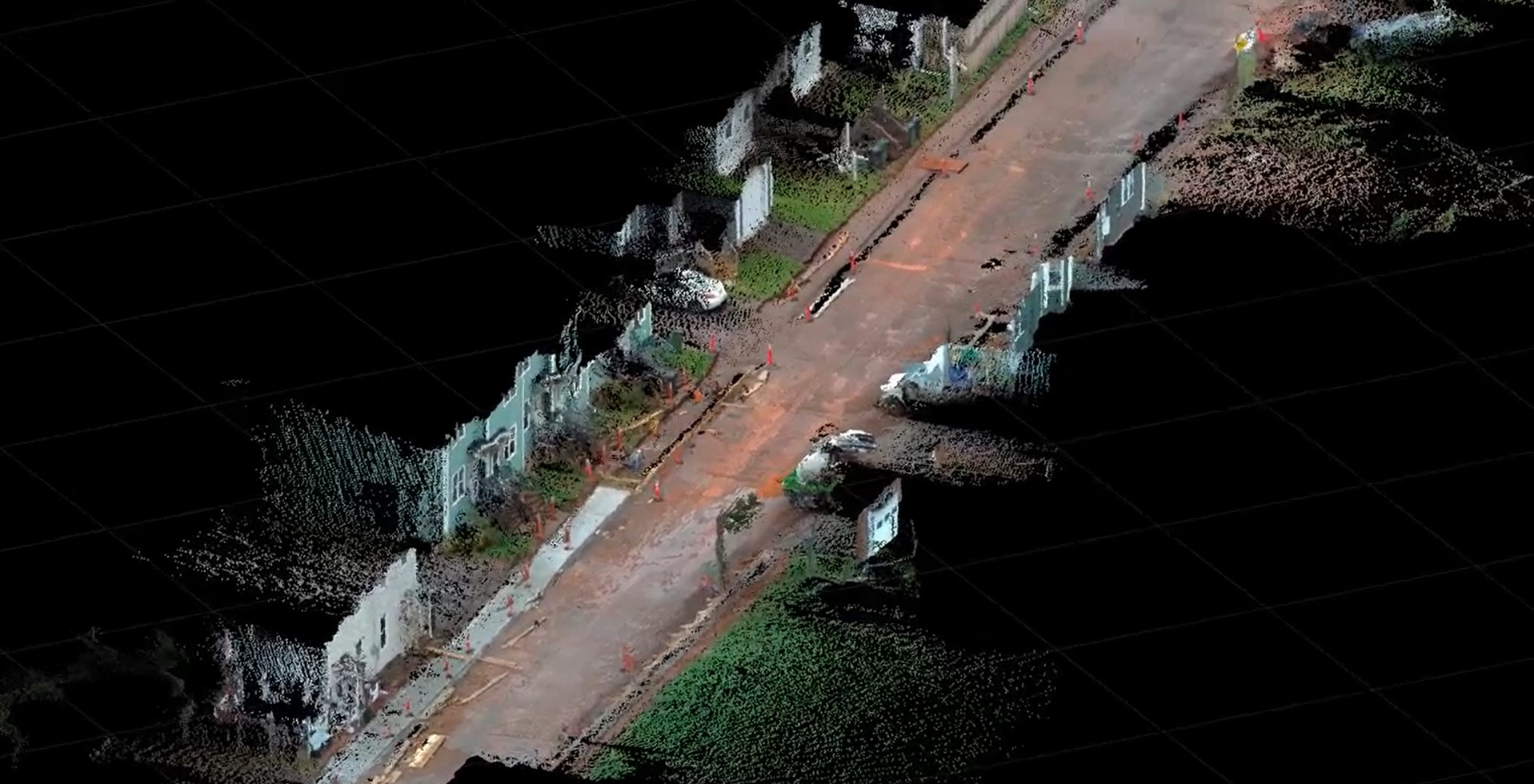
Andrew Gillis of Leica Geosystems shows a fast, easy way to collect survey data for a road construction project using the GS18 I GNSS smart antenna.
How long would it take you to collect accurate, comprehensive survey data and features on 330 feet of roadway for a road construction project?
With the click of a few buttons, Andrew Gillis of Leica Geosystems collected this dataset and imagery in less than 15 minutes using the Leica GS18 I GNSS smart antenna and CS30 field tablet. Back in the office and 45 minutes later, he had the data processed and point clouds created in Leica Infinity software. “An impressive feat,” he says, “with the kicker being that we can go back and walk through the site images, creating points in 3D on any feature desired, from manholes to building corners. Alternatively, simply export the point cloud from Infinity and import into a CAD package for digitizing features, designing from the as-built or calculating volumes.”
To talk to one of our experts and learn more about solutions for surveying and mapping, please contact us.


