Kyle Palmer, RPLS, demonstrates the speed and simplicity of manually reclassifying mobile lidar data with the latest point cloud processing tools.
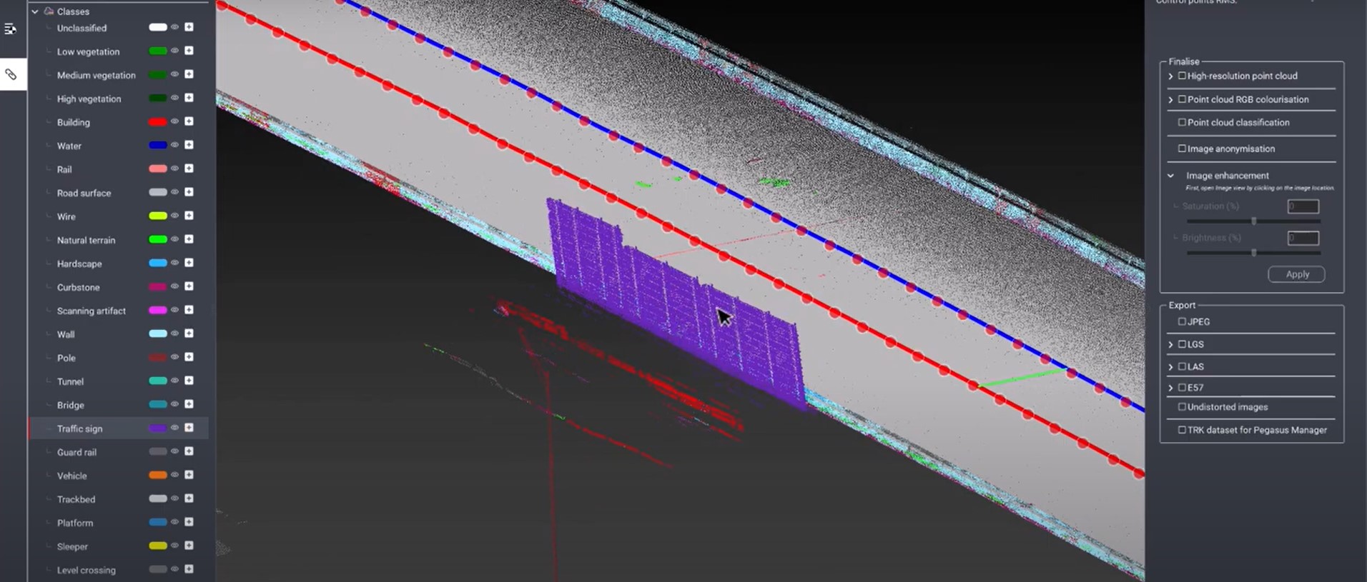
Automation and artificial intelligence have significantly streamlined the data classification process with mobile mapping, but it isn’t always perfect. What happens when your data isn’t classified correctly? For example, maybe the software has classified one section of the data as a wall when it’s really a road sign?
With the tools in Leica Cyclone Pegasus OFFICE version 2022.2, manually reclassifying your point cloud data is so fast and easy that it’s almost like magic. Kyle Palmer, RPLS, demonstrates how to use layers, highlighting, and just a few clicks to customize your spatial data, ultimately leading to information that is easier to analyze and interpret. In addition to the reclassification tool, the software’s guided workflows and high-precision point cloud analysis allow you to move from field data collection to final deliverable as efficiently as possible.
Anyone with a current Leica Cyclone Pegasus OFFICE license can take advantage of the manual point cloud reclassification tool. The latest version of the software can be downloaded from the Leica MyWorld portal.
About the Author:
 Kyle Palmer, RPLS, began his career as an instrument operator and survey crew chief before finding his calling in reality capture. After 15 years of working with lidar data, Kyle is relieved to finally have access to technology that streamlines the entire workflow, and he’s thrilled to be able to share his expertise with other surveying and mapping professionals. As mobile mapping consultant for Leica Geosystems, Kyle assists private firms and public agencies of all sizes in their mobile mapping journey. Follow Kyle on LinkedIn.
To talk to one of our experts and learn more about mobile mapping solutions or other ways to optimize your surveying potential, please contact us.


