Leica Geosystems Surveying

  • Smart Antennas
    • Options
      • Overview
      • GS18 I
      • GS18 T
      • GS05
      • GS16
      • GS07
  • Total Stations
    • Options
      • Overview
      • MS60
      • TS16
      • TS13
      • FlexLine
      • Smart Pole
  • Captivate
    • Options
      • Captivate
        Field Software
      • Captivate
        Pipeline
      • Captivate
        Quick Stake
      • CS20
      • CS30
      • CC200
      • CC180
  • Reality Capture
    • Options
      • Mobile Mapping
      • Laser Scanning
  • GIS
  • RTK Network
  • Survey DNA
  • Insights
  • Contact Us
All things
MULTI-SENSOR DATA CAPTURE
Insights HomeGrow Your Business
Improve Your Skills

REALITY CAPTURE EDUCATION SERIES:
Two Easy Ways to Achieve Grid to Ground Coordinate Transformations with Mobile Mapping

Monday, 17 July 2023 by Christine Grahl

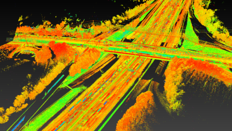
Join Kyle Palmer in this on-demand session to learn how easy it can be to localize and transform the coordinate values in your mobile mapping projects.

  • Published in Featured Home, Featured Improve Your Skills, Improve Your Skills
Tagged under: COORDINATE SYSTEM TRANSFORMATIONS, DATA MANAGEMENT, DELIVERABLES, KYLE PALMER, MOBILE MAPPING, MULTI-SENSOR DATA CAPTURE, OFFICE SOFTWARE, PEGASUS TRK, POINT CLOUDS, PRODUCTIVITY, REALITY CAPTURE, REALITY CAPTURE EDUCATION SERIES, WEBINARS
© 2025 Leica Geosystems – Part of Hexagon | Privacy Policy | Code of Business Conduct and Ethics | Cookies Settings
TOP