In the early days of electronic data collection, survey information was acquired with essentially no visual feedback. Advances in technology have provided the ability to show ever increasing visual information related to the project on the display of the user interface. This started with a fundamental display of points, then advanced to the display of automated linework.
Today, linework is no longer enough. To verify complete project data, you need a richer visual experience complemented by the ability to display acquired survey data on high-resolution photographs. The ability to display background maps in the field is a great way to enhance the visualization of your project data.
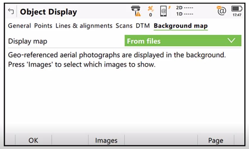
With the latest Captivate field software, you can display background map information directly in the 3D viewer. The software gives you the ability to use static georeferenced images. Additionally, you can stream Web Map Services (WMS) or Web Map Tile Services (WMTS) in real time as you navigate around the site. You can compare measured locations to existing features and use the maps for better orientation in the field.
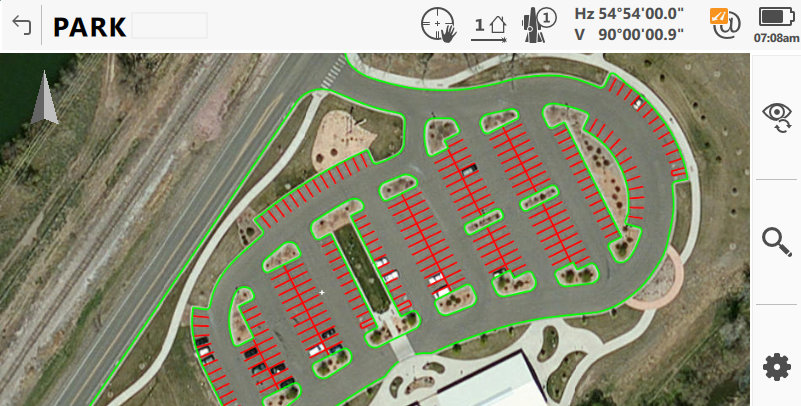
“Using background maps helps you ensure that the data you acquire is properly located,” says Burke Asay, technical support specialist for Leica Geosystems US/CAN. “It can also help you verify that you’ve acquired all information prior to leaving the site, saving you valuable time in avoiding return trips.”
A new Tech Tips video from the Leica Geosystems Surveying & Engineering (S&E) support team walks you through how to use background maps in Captivate field software. Watch the video here.

>>Related: Do You Know What Your Total Stations and GNSS Receivers Can Really Do?
To explore surveying solutions that can help you maximize productivity and performance, please contact us.