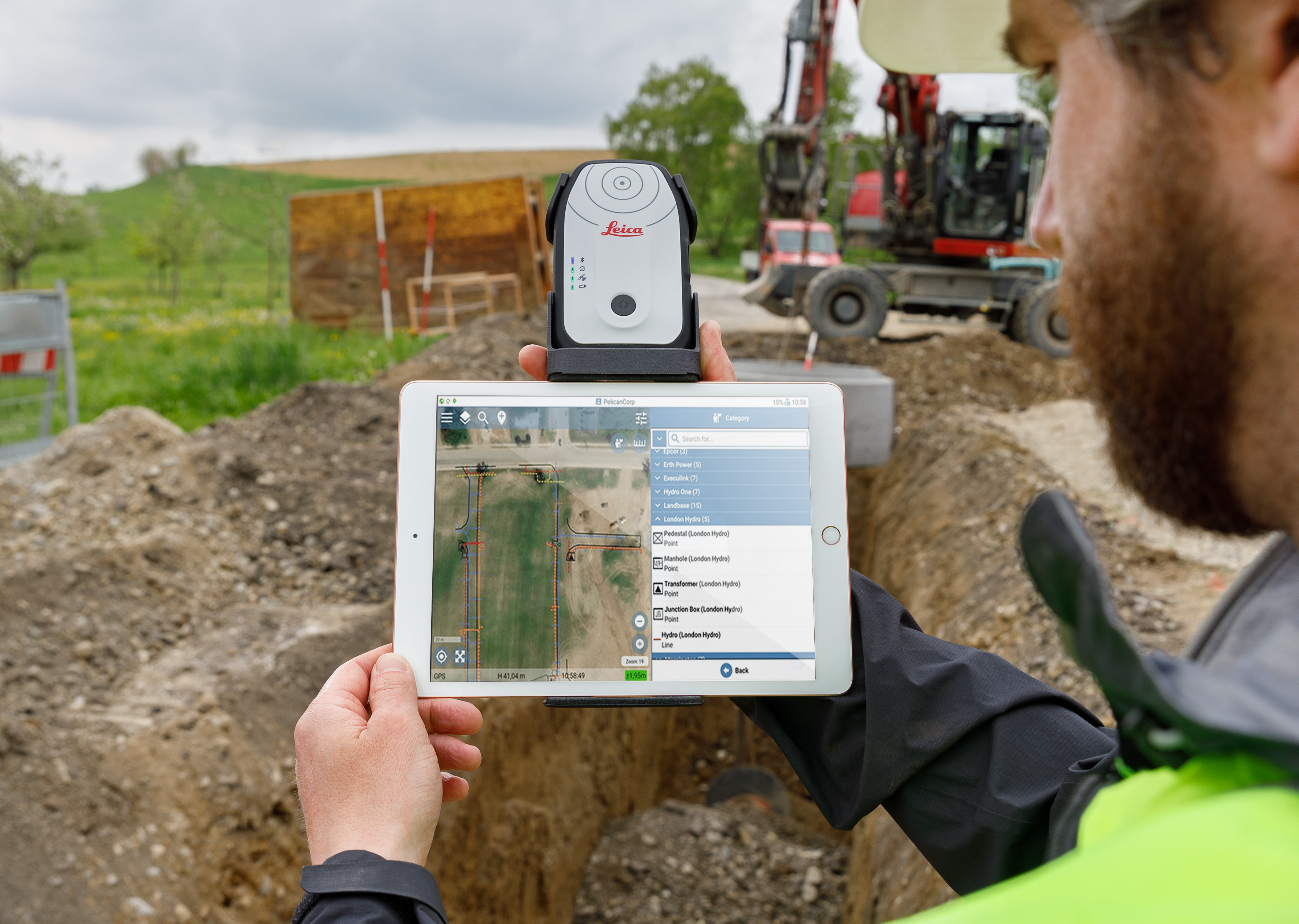
The ability to use Geolantis.360 with the Leica Zeno FLX100 plus optimizes utility mapping precision and reliability.
Accurate locations of subsurface utility assets are essential for ensuring the safety, efficiency, and cost-effectiveness of a range of construction projects, from transportation infrastructure to utility expansion, municipal improvements, and more. But data collection needs to be handled quickly and easily, with seamless data transfer between the field and office. The ability to use Geolantis.360 with the Leica Zeno FLX100 plus offers an impressive solution.
Geolantis.360 provides cloud-powered, effective communication between the office and field.
Known as the leading geospatial solution for capturing and pinpointing the exact location of subsurface assets, Geolantis.360 from Pelican Corp. offers a user-friendly interface that encompasses all mapping capabilities. Comprising both a web portal and mobile app, Geolantis.360 allows you to collect and build maps instantly and share them with your office in seconds. It provides a rapid return on investment (ROI) by allowing field workers to access and manipulate existing data, transforming the field into a data center.
Geolantis.360 works both online and offline. Field data is immediately and automatically synchronized with the web backend. You can create digital forms and checklists in minutes, with all annotations standardized and stored in the cloud. You can also take photos and annotate them by embedding timestamps and locations.
Users of Geolantis.360 report increased data quality, increased situational awareness, cost savings, and increased safety compared to utility sketching and other subsurface utility asset mapping methods.
Now Geolantis.360 is fully integrated with the Leica Zeno FLX100 plus smart antenna for optimum utility mapping precision and reliability.

The Leica Zeno FLX100 plus is an easy-to-use, single-button device for GIS data collection. With minimal setup or learning curve, the FLX100 plus is ready to use right out of the box with an iOS, Android or Windows device. The tool’s simplicity and flexibility lets users capture positioning data effortlessly and efficiently, regardless of their surveying background or expertise. Users appreciate its simplicity, compact and cable-free design, long battery life (more than 20 hours), and affordable price point.
The combination of Geolantis.360 with the Leica Zeno FLX100 plus provides contractors, locators, and professionals in the utility industry with a robust, precise, enterprise-level end-to-end utility mapping solution from the field to the office.
“Many of our customers prefer the Leica Geosystems technology because of the quality—they want the Leica experience,” says Michael Pegam, Geolantis.360 sales director. “The ability to use Geolantis.360 with the FLX100 plus provides an outstanding way to document and protect utilities, especially subsurface assets. This technology pairing enhances communication between the office and field by making accurate datasets easier to collect and access.”
To talk to one of our experts and learn more about ways to optimize your mapping potential, please contact us.


