

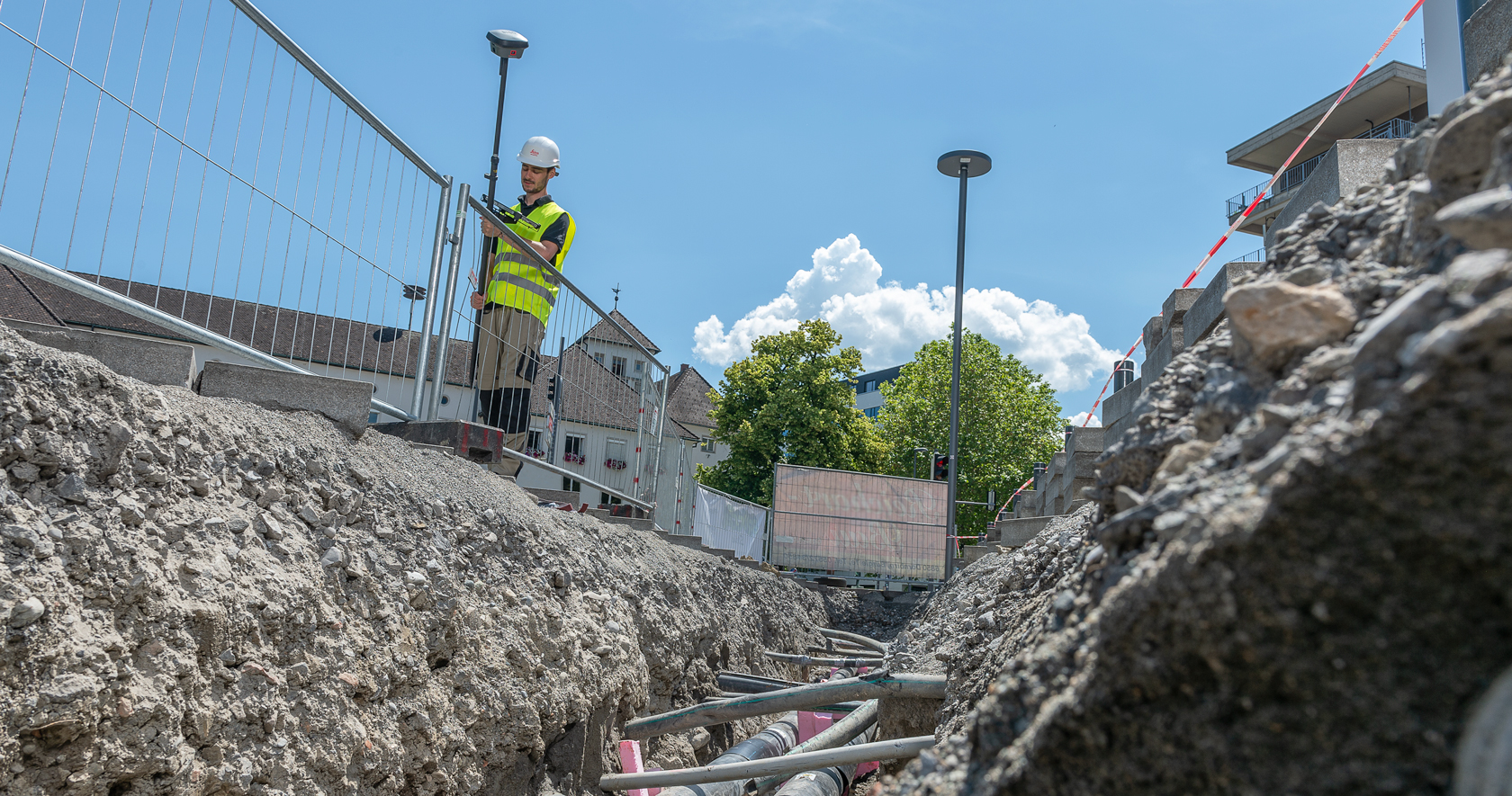
The ability to capture accurate points from a distance with images provides a significant leap in safety and efficiency for subsurface utility engineering.
Enhanced safety is a key benefit of subsurface utility engineering (SUE). Knowing exactly what’s underground and where provides crucial insight to avoid utility strikes and keep construction projects on track. But capturing SUE data requires sending people onsite, first to locate and mark the probable utilities, and then to excavate and survey precise horizontal and vertical locations for the as-built drawings and maps. For projects near roadways and other hazardous locations, that means two potential instances of road closures, project shutdowns—and putting someone in harm’s way.
Technology advances provide opportunities to significantly reduce this exposure. On the utility detection side, innovations in ground penetrating radar (GPR) have made it much faster and easier to locate, visualize and create 3D utility maps in the field and quickly export the results to CAD and BIM formats. On the surveying side, advances in GNSS to integrate real-time tilt compensation have improved safety by allowing surveyors to step away from traffic or other hazards and capture accurate measurements without leveling the rod.
Now there’s another GNSS innovation that can do even more to safeguard surveyors in the field: GNSS RTK with integrated visual positioning. The ability to capture accurate points from a distance with images provides a significant leap in safety and efficiency that should make you question your surveying process for SUE and, ultimately, lead to changes across the entire utility industry.
Capturing Complete, Accurate Utility Data at a Distance
GNSS receivers are already an established method of precise positioning in SUE, but they have limitations. In areas where points are inaccessible or obstructed, or metallic pipe is exposed, surveyors have traditionally needed to rely on other measurement approaches. The emergence of GNSS rovers with integrated inertial measurement units (IMUs) that are self-leveling, immune to magnetic disturbance and don’t require calibration has created new opportunities to bring the efficiency of GNSS to underground utility surveying, along with some safety improvements. But even the ability to tilt the rover doesn’t remove the surveyor from the situation completely.
Take that same GNSS RTK rover concept and expand the sensor fusion to include a camera for visual positioning, which is the innovation in the new Leica GS18 I, and now you can keep your distance from traffic, active construction and other potential hazards while still capturing measurements at survey-grade accuracy, simply by taking images as you walk around the area of interest at a regular walking pace. You can capture hundreds of measurements in minutes, which minimizes the amount of time you have to spend onsite. And you can instantly verify in the images that you’ve captured all the data you need, ensuring that you won’t need to make any return trips.
Because visual positioning enables you to capture hundreds of points in minutes, you don’t even need to worry about scope creep. If additional points are needed later, you can extract them from the imagery in the office to survey grade—further limiting your exposure to potential hazards onsite. “The real power of this GNSS innovation is in the ability to drill down into single point measurements from images,” says Bob Kilburn, surveying and engineering product and applications manager for Leica Geosystems in the U.S. and Canada. “So now you’re minimizing time onsite, keeping your distance from hazardous situations onsite, and avoiding return trips, while still getting the accuracy you need, even in challenging environments. I really can’t overstate the significance of this advance for improving utility surveying safety and efficiency.”
Facilitating a Digital Twin of Underground Infrastructure
Taking safety a step further requires rethinking utility data from the outset and capturing accurate 3D as-built data as the utilities are installed. Working from accurate 3D models of existing underground and aboveground infrastructure has already proven to reduce or eliminate utility strikes and change orders while allowing projects to be completed faster. Capturing comprehensive, accurate measurements while the trench is open during construction informs the as-built documentation with real-world conditions that will reduce risks and costs later on. Capturing additional 3D as-built data whenever changes occur keeps models current.
Here, too, GNSS with visual positioning can play a valuable role. Used alone or in conjunction with 3D laser scanning and GPR, GNSS with visual positioning can quickly and safely capture the accurate 3D as-built data essential to streamlining design, avoiding clashes, reducing the need for vacuum excavation, shortening construction time and minimizing risk. Whether near an open trench or in the location of a buried asset, the ability to rapidly capture hundreds of accurate survey points from a distance makes you more efficient while keeping you out of harm’s way.
Having current, accurate digital models of underground infrastructure—a digital twin—is already established as a best practice for highway construction projects. Some states have even begun mandating that all public civil construction projects have SUE surveys prior to engineering design. But maximizing safety and efficiency in these surveys requires using the right technology.
The introduction of GNSS with integrated visual positioning provides a new opportunity to raise the bar on the accuracy, efficiency, completeness—and safety—of SUE surveys.
Learn More About the New GS18 I GNSS RTK Rover in These Virtual Events
About the Author:
 Simon Pedley has been involved in the utility detection market for more than 17 years, providing technical support, field support and training during much of his career. As a detection solutions specialist for Leica Geosystems, Simon focuses on helping professionals in surveying, engineering and construction understand and implement technology to achieve damage prevention, safety monitoring and high-value utility mapping. He specializes in solutions from IDS GeoRadar and Leica Geosystems, which are both part of Hexagon and offer a seamless digital approach to utility detection.
To talk to one of our experts and learn more about solutions for safe, efficient utility detection and surveying, please contact us .


