

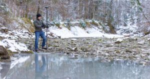
Entering live traffic to capture details such as a manhole is one of the most unnerving things a surveyor has to do. Watch this video to see how innovations like the GS18 I let you capture that information from the safety of the sidewalk.
>> Explore the interactive demo
LEARN MORE
Interactive PDF Answers FAQs about the GS18 I GNSS RTK
 This PDF covers the questions surveyors are asking most about the new GNSS RTK with visual positioning.
On-Demand Webinar Shows How to Use GNSS Innovations to Optimize Your Surveying Field Workflows
 Advanced signal tracking, self-learning capabilities, tilt compensation, visual positioning—the latest advances offer big advantages.
On-Demand Webinar Shows Optimal Survey Data Workflow Using Infinity Software
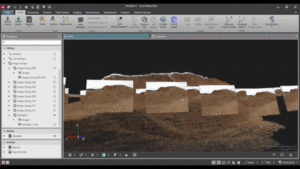 If you’re still taking your GNSS and other survey data directly from the field into CAD, you need to see what you’re missing.
How to Truly Benefit from GNSS Modernization
 Taking full advantage of new satellites and multifrequency signals requires dynamic surveying technology.
Technology Review: New GS18 I GNSS RTK Rover Yields ‘Impressive Results’
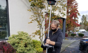 How does the GS18 I perform in the real world? Gavin Schrock of Geospatial World evaluates the integrated sensor technology.
To talk to one of our experts and learn more about this groundbreaking new solution, please contact us .


