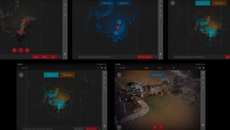
How VIS Technology Advances Laser Scanning
The ability for a laser scanner to “see” where it is at each setup and track its own movement brings a greater return on investment to laser scanning.
- Published in Improve Your Skills
How to Compare High-Speed Laser Scanners
Spec sheets might be a starting point for choosing a laser scanner, but details that aren’t on the spec sheet also matter. Here’s what you should look for in the demo and the data.
- Published in Improve Your Skills
On-Demand Webinar Provides Practical Advice for Entry-Level Laser Scanning
Technology advances make it easier than ever for surveyors to get involved in laser scanning, but strategy matters. Understanding the key considerations in making technology decisions will position you for the best success.
- Published in Featured Home, Improve Your Skills
Four Key Questions When Comparing Mobile Mapping Systems
Are you ready to expand your business into mobile mapping? Here are four key questions to ask to make sure you get the maximum ROI.
- Published in Grow Your Business
The Where, When, What and Why of Mobile Mapping
What exactly is a “mobile mapping system”? What are its component parts? And why would you want to use a mobile mapping system, anyway?
- Published in Grow Your Business
Video: This Survey Firm Knows the Secret to Great Client Relationships
What’s the best way to set your firm apart and complete high-quality work quickly and accurately? Titcomb Associates shares their strategy.
- Published in Featured Grow Your Business, Featured Home, Grow Your Business
How Surveying Technology Partnerships Create a Solid Foundation for Smart Cities
Accurate geospatial data is crucial to creating the cities of the future. Sam Dougherty, PLS, explains why working with the right technology partner matters.
- Published in Grow Your Business
Safeguard Your Survey Gear with LOC8
With the ability to track your instruments and lock them from any location, LOC8 is the no-worries way to achieve high productivity surveying in any environment.
- Published in Featured Grow Your Business, Grow Your Business
Three Essential Elements of a Successful Mobile Mapping Partnership
If you’re teaming up with another organization to complete a project, here’s how you can ensure everything runs smoothly and efficiently.
- Published in Improve Your Skills
How Cross-Training Drives Productivity in Mobile Mapping
The back-office adjustments of mobile mapping are easy to navigate as long as you prepare for them and offer training to your workforce.
- Published in Improve Your Skills

